Moderately difficult hikes

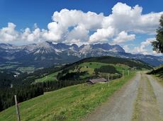
Featuring fantastic panoramic views, experience the Wilder Kaiser region and its diverse landscape along numerous mountain trails of intermediate difficulty. Afterwards, reflect on the day’s events at rustic mountain huts offering delicious food and drink.

54 Routes and tours

Eagle Walk Stage 01: St. Johann in Tirol - Gaudeamushütte

Eagle Walk Stage 01: St. Johann in Tirol - Gaudeamushütte

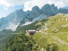
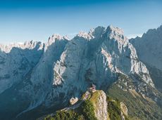
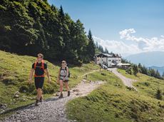
Sturdy boots will help keep your ankles and feet happy on this hike, full of the best things Tirol has to offer: well-maintained trails, wildflowers galore and waterfalls beckon the adventurous hiker ready for a strenuous climb with breathtaking views of lofty Wilder Kaiser Mountain Range as your reward. The nature reserve’s landscape will win you over with its diverse beauty. The pasture regions are covered with soft grassy meadows, and hikers are greeted by lofty Wilder Kaiser Mountain Range with rugged Maukspitze, Ackerlspitze, Regalpspitze and Törlspitze Peaks, all “Two-Thousanders” that average 2,000 metres altitude. Trailhead is Rummlerhof Inn, northwest of the village centre of St. Johann. After a successful first segment, why not take a rest at Gaudeamus Hut, raise your glass and sing: “Gaudeamus igitur – Let us be happy!” For many hikers this is far enough, contentment has already set in. Adventurous souls continue on the trail that works its way up across Klamml Gorge to Grutten Hut, which entails another 400 metres of climbing.

Rummlerhof, St.Johann in Tirol

Gaudeamushütte

Hiking

Intermediate

5:00 h

13,0 km

1060 Elevation gain

Gruttenhütte circuit

Gruttenhütte circuit
ClosedGruttenhütte circuit
Gruttenhütte circuit

Panoramic circular walk in the Wilder Kaiser leading to the highest mountain hut in the region.

Hiking starting point Tourist Info, Ellmau (800 m)

Hiking starting point Tourist Info, Ellmau (800 m)

Hiking

Intermediate

6:00 h

15,7 km

870 Elevation gain

Kaiserkrone - stage 5

Kaiserkrone - stage 5

Gasteig – Wilder-Kaiser-Steig – Ursulablick – Gscheuerkopf – Graspoint-Hochalm – Graspoint-Niederalm – Going, Hüttling

Gasteig (750 m)

Hiking starting point Hüttling, Going (820 m)

Hiking

Intermediate

5:15 h

10,8 km

840 Elevation gain

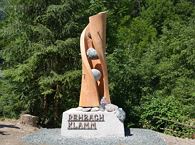
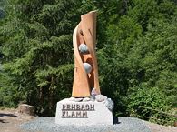
Rehbachklamm

Rehbachklamm
Rehbachklamm
Rehbachklamm

Themed hiking route with a trail full of natural experiences alongside the refreshing water.

Hiking starting point Tourist Info, Scheffau (738 m)

Hiking starting point Tourist Info, Scheffau (738 m)

Hiking

Intermediate

2:30 h

7,2 km

300 Elevation gain

Hochlechen circular route

Hochlechen circular route

Old path - now renovated and featuring a pleasant series of ascents and descents.

Hiking starting point Bergbahn, Söll (725 m)

Hiking starting point Bergbahn, Söll (725 m)

Hiking

Intermediate

4:30 h

13,5 km

470 Elevation gain

Kaiserkrone - around the Wilder Kaiser in 5 days

Kaiserkrone - around the Wilder Kaiser in 5 days

Wild and free - 5 days of hiking on old paths around the Wilder Kaiser The five-day hike from hut to hut is one of the most beautiful multi-day circular tours in Tirol. It takes mountain walkers along a route of around 58 kilometres, featuring ascents and descents with a difference in altitude of approximately 4,000 metres as they circle around the imposing Wilder Kaiser massif.

Hiking starting point Hüttling, Going (820 m)

Hiking starting point Hüttling, Going (820 m)

Hiking

Intermediate

27 h

57,7 km

4000 Elevation gain

Ackerlhütten circular hike

Ackerlhütten circular hike

Intermediate circular hike with breathtaking views on the surrounding mountains. Attention: Trail no 828 is closed due to danger of falling rocks. Detour via path no. 816 and 827 via the Obere Regalm to the Baumgartenköpfl.

Hiking starting point Tannbichl, Going (857 m)

Hiking starting point Tannbichl, Going (857 m)

Hiking

Intermediate

4:45 h

9,8 km

760 Elevation gain

Kaiserkrone - stage 4

Kaiserkrone - stage 4

Stripsenjochhaus – Stripsenkopf – Feldberg – Scheibenbichlalmen – Griesenau – Gasteig

Stripsenjochhaus, St. Johann in Tirol (1,577 m)

Gasteig (750 m)

Hiking

Intermediate

6:30 h

16,1 km

640 Elevation gain

Kaiserkrone - stage 1

Kaiserkrone - stage 1

Going, Hüttling – Graspoint-Niederalm – Obere Regalm – Brennender Palven – Gaudeamushütte – Klamml – Gruttenhütte

Hiking starting point Hüttling, Going (820 m)

Gaudeamushütte, Going (1,263 m) / Gruttenhütte, Ellmau (1,620 m)

Hiking

Intermediate

4:30 h

8,0 km

1120 Elevation gain

Quellen circular route

Quellen circular route

Enjoy the scenic area of the Hohe Salve where the Söll waters originate.

Exit Keat chairlift, Söll (1,533 m)

Exit Keat chairlift, Söll (1,533 m)

Hiking

Intermediate

3:45 h

10,3 km

530 Elevation gain

Eagle Walk Stage 02: Gaudeamushütte - Kaindlhütte

Eagle Walk Stage 02: Gaudeamushütte - Kaindlhütte

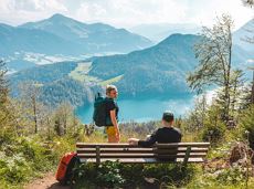
Is it about the journey or the destination? Well, one of the destinations of this stage is definitely the Hintersteiner See lake and its views. Surrounded by stunning mountain vistas, dwarf pine scrubland and beech forests, the lake is one of the cleanest and most beautiful mountain lakes in Tirol. The private pristine gem covers 56 hectares and measures 36 metres at its deepest point. With this picture-perfect backdrop, hikers will complete the remaining distance to the Kaindlhütte hut in no time.

Gaudeamushütte

Hintersteiner See

Hiking

Intermediate

6:30 h

15,1 km

888 Elevation gain

Hochalm hike

Hochalm hike
Hochalm hike
Hochalm hike

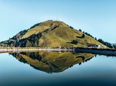
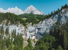
A circular route full of experiences that leads from the Seebachgraben gorge to the Wilder-Kaiser-Steig trail - discover one of the most beautiful parts of Scheffau!
Hiking starting point Tourist Info, Scheffau (738 m)

Hiking starting point Tourist Info, Scheffau (738 m)

Hiking

Intermediate

7:00 h

19,6 km

1140 Elevation gain

Scheffau – Gruttenhütte

Scheffau – Gruttenhütte

Hike to the Gruttenhütte with great views to the Ellmauer Halt and the entire region.

Hiking starting point Tourist Info, Scheffau (738 m)

Gruttenhütte, Ellmau (1,620 m)

Hiking

Intermediate

6:30 h

16,4 km

990 Elevation gain

Pölvenau circular route

Pölvenau circular route
Partially openPölvenau circular route
Pölvenau circular route

Pleasant circular hiking trail through forests and meadows to the romantically situated moor lake.

Hiking starting point Franzlhof, Söll (703 m)

Hiking starting point Franzlhof, Söll (703 m)

Hiking

Intermediate

2:00 h

5,7 km

240 Elevation gain

Eagle Walk Stage 03: Kaindlhütte - Kufstein

Eagle Walk Stage 03: Kaindlhütte - Kufstein

This stage takes hikers to the small town of Kufstein located on the banks of the Inn river – a town which has been celebrated in song and is steeped in history and character. Walkers make their way through the lush and verdant beauty of a pasture paradise with cosy huts and mountain restaurants before stopping for a rest at the Brentenjochhütte hut (delicious “Kiachl” are served every Saturday).

Hintersteiner See

Kufstein

Hiking

Intermediate

4:00 h

12,5 km

160 Elevation gain

Kaiserkrone - stage 3

Kaiserkrone - stage 3

Kaindlhütte - Bettlersteig - Anton-Karg-Haus - Hans-Berger-Haus - Stripsenjochhaus

Hintersteiner See, Scheffau (889 m)

Stripsenjochhaus, St. Johann in Tirol (1,577 m)

Hiking

Intermediate

5:00 h

9,3 km

840 Elevation gain

Rübezahlschnitzweg

Rübezahlschnitzweg
Rübezahlschnitzweg
Rübezahlschnitzweg

Family hike on Austria’s longest sculpture trail

Hartkaiser summit station, Ellmau (1,555 m)

Rübezahl-Alm, Ellmau (1,174 m)

Hiking

Intermediate

1:00 h

2,5 km

50 Elevation gain

Going – Gruttenhütte circular walk

Going – Gruttenhütte circular walk

A unique hike to the highest mountain hut in the Wilder Kaiser region featuring a panoramic view.

Hiking starting point Going center (former tourist information Going) (764 m)

Hiking starting point Going center (former tourist information Going) (764 m)

Hiking

Intermediate

6:00 h

14,0 km

890 Elevation gain