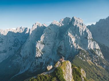
Starting point: GaudeamushütteFrom the Gaudeamushütte hut, a steep path winds its way up 400 vertical metres to the highest-lying mountain hut in the Wilder Kaiser Mountains, the Gruttenhütte. From there, first head towards the Ellmauer Tor and then turn onto trail number 824, 813 that winds westward through scree and talus slopes and dwarf pine scrubland. Cross a dry creek bed until you reach a signed trail (“Gruttenhütte über Klamml”) that branches off. Walkers must be sure-footed and have a good head for heights to negotiate this section. The trail becomes increasingly rock-laden, slowing your pace as you clamber up and around large boulders, offering occasional views of the Gaudeamushütte hut below. Make your way around and up the rocks assisted by a fixed anchoring system of cables and a two-metre iron ladder. Follow the narrow, rocky trail bordered by towering rock faces to the right and a talus slope to the left. Traverse a debris-filled chute on your way to the entrance to the Klamml gorge. This is where your vertical adventure begins. The via ferrata with bolted handholds and footholds heads off to the right from the Gruttenkopf mountain. It is steep and requires use of hands in one short section going over a headwall. Bear left at the end of the via ferrata. From there it is a short walk to the Gruttenhütte hut. Shortly after, the trail crosses the Jubiläumssteig trail coming from the right.
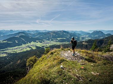
Food & drink: Gruttenhütte From the Gruttenhütte hut (1,620m), follow the "Gruttenweg" trail (number 14a) and head southwest. At Krummbachegg, at an elevation of 1,400 metres, “Höhenweg” (literally, ‘high-altitude trail’) number 823 branches off from the Gruttenweg trail and runs westward (“Hintersteiner See”). Keep walking along the high-altitude trail, which is also called “Wilder-Kaiser-Weg“, taking you through thin mixed woods and dwarf pines south of the Treffauer mountain and right around it. Continue hiking towards “Kaiser Hochalm”. From Kaiser Hochalm (1,417m), surrounded by wide open alpine meadows, head downhill on the marked trail. Follow the signs to “Steiner Hochalm” and hike down across mixed forest along trail number 823. At the end of the forest you will reach a fork – bear right and follow the signposted trail that skirts the slope on the left-hand side and takes you up to the Steiner Hochalm. This quaint alpine hut is a great place to gather new strength over a hearty snack. On occasions there is even live harp music!
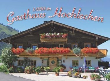
Food & drink: Steiner Hochalm
From the Steiner Hochalm hut, follow the Jägersteig trail to the Walleralm hut where you can recharge your batteries again. Behind the hut, there is a signposted trail leading to the Kaindlhütte mountain hut. It’s an easy uphill walk to the Hochegg mountain at 1,470 metres, only the last bit is a tad steeper. Enjoy the views over the Inntal valley and the Zahmer Kaiser mountain before you head down through open alpine meadows to the Steinbergalm and Kaindlhütte mountain huts.
Finishing point: Kaindlhütte


 Deutsch