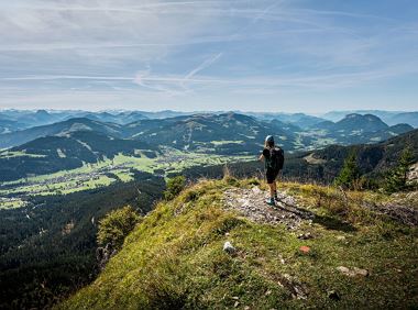
Eagle Walk Stage 01: St. Johann in Tirol - Gaudeamushütte

Eagle Walk Stage 01: St. Johann in Tirol - Gaudeamushütte

Description


trail description: Trailhead of Eagle Walk Segment #1 is Rummlerhof Inn in the hamlet of Hinterkaiser, northwest of the village centre of St. Johann in Tirol. Traveling by car, you can leave your car at the Steinlechnerplatz/Dampflfeld car park (for free; some 400m from the tourist information office). From Rummlerhof Inn, take the narrow paved road and walk westwards towards Maurerhof, following signage to “Schleierwasserfall”. Pass the (farm)house No. 80 on its left hand side. Now, an easy climb takes you through a thicket of trees. Cross the forest road and follow the red-white blazes upstream along a brook. The trail eventually joins a forest road, turn left first, then right towards “Schleierwasserfall” (keep walking on Trail No. 33 until you reach Schleier Waterfall).

You’ll access the falls along a steep path that winds through forest and takes you to Diebsöfen; and you will make your way around and up the cliffs assisted by a fixed anchoring system of cables. A brook winds along a perpendicular rock face—this is where you will find a cave. Descend to the brook and follow the markings in the cave (the trail traverses the cave). From Diebsöfen, an easy climb takes you up to mighty Schleier Waterfall. From there, take Trail No. 818 heading south and continue as far as the first fork in the trail. Here, head in a northeasterly direction through alpine meadows to the "Stiegenbachwasserfall". From there follow signage to “Regalm” and “Gaudeamushütte”. The trail enters the wide open world of Alpine pastures, descends again and eventually turns onto a forest road that takes you to "Obere Regalm" hut.

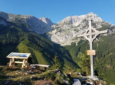
Above the hut, walk towards “Gaudeamushütte” with the trail climbing atop a saddleback (right next to it is where you will find the mountaineer’s grave atop Brennender Palven). On the other side of the col the trail descends towards “Gaudeamushütte”, to an elevation of 1,270 metres. You’ll pass Freiberg Hut on your way down to Gaudeamus Hut, your comfy base for the night (keep to Trail No. 35 from the saddle onwards).

Read more

Information

    Read more

    • Fitness

    • Technical

    Best seasons

    • 01

      Jan

    • 02

      Feb

    • 03

      Mrz

    • 04

      Apr

    • 05

      May

    • 06

      Jun

    • 07

      Jul

    • 08

      Aug

    • 09

      Sep

    • 10

      Oct

    • 11

      Nov

    • 12

      Dec

    More tours

    Rauher Kopf

    Rauher Kopf
    Rauher Kopf
    Rauher Kopf

    Over hill and dale through idyllic nature up to the Rauhen Kopf.

    Astberg Bergstation

    Astberg Bergstation

    Hiking

    Intermediate

    4:45 h

    13,1 km

    620 Elevation gain

    Hochlechen circular route

    Hochlechen circular route
    Hochlechen circular route
    Hochlechen circular route

    Old path - now renovated and featuring a pleasant series of ascents and descents.

    Hiking starting point Bergbahn, Söll (725 m)

    Hiking starting point Bergbahn, Söll (725 m)

    Hiking

    Intermediate

    4:30 h

    13,5 km

    470 Elevation gain

    Kaiserkrone - stage 2

    Kaiserkrone - stage 2
    Kaiserkrone - stage 2
    Kaiserkrone - stage 2

    Gruttenhütte - Kaiser-Hochalm - Steiner-Hochalm - Jägersteig - Walleralm - Hochegg - Kaindlhütte

    Gruttenhütte, Ellmau (1,620 m)

    Hintersteiner See, Scheffau (889 m)

    Hiking

    Intermediate

    5:30 h

    13,5 km

    560 Elevation gain

    Weather

    Today

    2024-12-22

    1 °C

    • -4° Valley
    • 5 km/h
    • -1° Mountain
    • 80 %

    Tomorrow

    2024-12-22

    2 °C

    • -4° Valley
    • 10 km/h
    • Mountain
    • 90 %

    The day after tomorrow

    2024-12-23

    -1 °C

    • -3° Valley
    • 10 km/h
    • -5° Mountain
    • 90 %

    2024-12-24

    2024-12-24

    -1 °C

    • -3° Valley
    • 15 km/h
    • -6° Mountain
    • 90 %
    More

    Contact

    If you have any questions,we are happy to help.

    +43 50509
    or