


 Deutsch
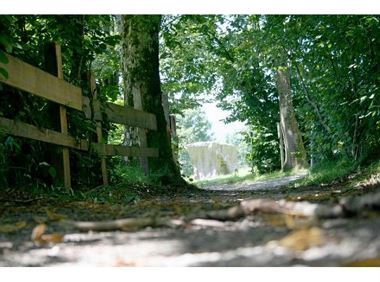
Parking area Steintal, Söll

Söll
(0043) 5333 5210
Read more
The composition of the trail varies between asphalt, forest trail and path with sections secured by ropes.
Rucksack, sturdy hiking/mountaineering boots with anti-slip treaded soles, weather-appropriate hiking gear (breathable), a change of clothes, sun protection (sunglasses, sun cream, lip protection, headgear), waterproofs (rain jacket/poncho, pocket umbrella, rucksack protector), cold protection (hat, gloves), sufficient food and drink, hiking poles (height adjustable) if required, first aid kit incl. rescue blanket and bivouac sack, mobile phone with fully charged battery, headlamp, plastic bag for waste, hiking map, route description and information materials (GPX track), ID, insurance card, cash
Read more
Regular bus stop Söll, Denggenbauer on line 4060.
More information at: www.wilderkaiser.info/mobility
Coming from Wörgl on the B178 main road, take the exit on the left, opposite the Söll business park, into the neighborhood of Ried. Follow the signs to "Alpenschlössl", after a 90° bend to the left past the houses, turn right at the next junction. After approx. 400 m you will reach the Steintal hiking starting point on the right-hand side.
Coming from St. Johann/Kufstein on the B178 main road, take the exit on the right, after the Söll business park, into the neighborhood of Ried. Follow the signs to "Alpenschlössl", after a 90° bend to the left past the houses, turn right at the next junction. After approx. 400 m you will reach the Alpenschlössl hiking starting point on the right-hand side.
Hiking starting point Alpenschlössl, Söll (762 m) - for free
Read more
Fitness
Technical
01
Jan
02
Feb
03
Mrz
04
Apr
05
May
06
Jun
07
Jul
08
Aug
09
Sep
10
Oct
11
Nov
12
Dec
Söll
(0043) 5333 5210

Enjoy the scenic area of the Hohe Salve where the Söll waters originate.
Exit Keat chairlift, Söll (1,533 m)
Exit Keat chairlift, Söll (1,533 m)
Hiking
Intermediate
3:45 h
10,3 km
530 Elevation gain
Gasteig – Wilder-Kaiser-Steig – Ursulablick – Gscheuerkopf – Graspoint-Hochalm – Graspoint-Niederalm – Going, Hüttling
Gasteig (750 m)
Hiking starting point Hüttling, Going (820 m)
Hiking
Intermediate
5:15 h
10,8 km
840 Elevation gain
Eventful hike for families with a great panoramic view and playgrounds for children.
Brandstadlbahn summit station, Scheffau (1,643 m)
Hexenwasser theme park, Söll (1,150 m)
Hiking
Intermediate
4:00 h
11,0 km
350 Elevation gain

Scenic and varied circular hike.
Hiking starting point Going center (former tourist information Going) (764 m)
Hiking starting point Going center (former tourist information Going) (764 m)
Hiking
Intermediate
4:00 h
11,0 km
500 Elevation gain

Intermediate circular hike with breathtaking views on the surrounding mountains. Attention: Trail no 828 is closed due to danger of falling rocks. Detour via path no. 816 and 827 via the Obere
Hiking starting point Tannbichl, Going (857 m)
Hiking starting point Tannbichl, Going (857 m)
Hiking
Intermediate
4:45 h
9,8 km
760 Elevation gain
A must for hikers in Söll - local history and culinary delights on the sunny side.
Hiking starting point Franzlhof, Söll (703 m)
Hiking starting point Franzlhof, Söll (703 m)
Hiking
Intermediate
3:45 h
11,0 km
420 Elevation gain
2025-04-16
22 °C
2025-04-17
20 °C
2025-04-18
12 °C
2025-04-19
17 °C
