


 Deutsch


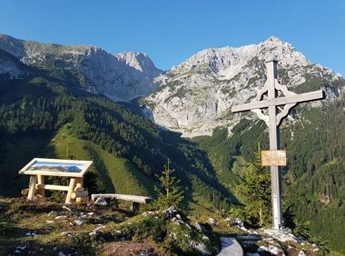
Tannbichl Chapel

Open - Today
Going am Wilden Kaiser
(0043) 50509 510
Read more
The composition of the trail varies between forest roads, paths,, meadow and forest trails..
Rucksack, hiking/mountaineering boots, hiking gear (breathable), sun protection (sunglasses, sun cream, headgear), waterproofs (hardshell), water bottle, food for eating on the way, hiking poles if desired, first aid kit, plastic bag for waste, hiking ma
Read more
KaiserJet stop “Going Pramakapelle” – followed by approx. 25-minute hike to the hiking starting point (Tannbichl).
More information at: www.wilderkaiser.info
Heading from St. Johann on the B178 road, take the Going Prama exit immediately after passing the Stanglwirt hotel. Drive straight on along the road in the direction of the Kaisergebirge mountain range. After passing the last of the houses, keep to the right as you head towards the Kaisergebirge until you reach the hiking starting point and the car park.
Heading from Wörgl or Kufstein on the B178 road, take the Going Prama exit before you reach the Stanglwirt hotel. Drive straight on along the road in the direction of the Kaisergebirge mountain range. After passing the last of the houses, keep to the right as you head towards the Kaisergebirge until you reach the hiking starting point and the car park.
Tannbichl car park, Going (857 m) - pay & display
It is a day car park, which means that no ticket can be purchased for several days. The parking ticket is therefore only valid on the day of issue!
Read more
Fitness
Technical
Experience
01
Jan
02
Feb
03
Mrz
04
Apr
05
May
06
Jun
07
Jul
08
Aug
09
Sep
10
Oct
11
Nov
12
Dec
Open - Today
Going am Wilden Kaiser
(0043) 50509 510
Family roundtrip through the Rebachklamm to the Seilabodenkreuz, via the Kaiseralm and the Jägerwirt back to the center of Scheffau.
Community Hall, Scheffau (740 m)
Community Hall, Scheffau (740 m)
Hiking
Intermediate
3:15 h
9,7 km
510 Elevation gain

From the flowery village to the water jewel of the Alps.
Hiking starting point Franzlhof, Söll (703 m)
Seestüberl restaurant, Hintersteiner See, Scheffau (890 m)
Hiking
Intermediate
3:15 h
9,5 km
460 Elevation gain

A picturesque mountain hike that leads from the turquoise waters of the most beautiful mountain lake in Tirol up to the rustic Alpine village.
Hiking starting point Seestüberl, Scheffau (890 m)
Hiking starting point Seestüberl, Scheffau (890 m)
Hiking
Intermediate
3:15 h
9,3 km
360 Elevation gain

Kaindlhütte - Bettlersteig - Anton-Karg-Haus - Hans-Berger-Haus - Stripsenjochhaus
Hintersteiner See, Scheffau (889 m)
Stripsenjochhaus, St. Johann in Tirol (1,577 m)
Hiking
Intermediate
5:00 h
9,3 km
840 Elevation gain

Enjoy the scenic area of the Hohe Salve where the Söll waters originate.
Exit Keat chairlift, Söll (1,533 m)
Exit Keat chairlift, Söll (1,533 m)
Hiking
Intermediate
3:45 h
10,3 km
530 Elevation gain
The viewpoint mountain of the locals, steep and fascinating.
Hiking starting point Alpenschlössl, Söll (762 m)
Hiking starting point Alpenschlössl, Söll (762 m)
Hiking
Intermediate
5:00 h
10,4 km
790 Elevation gain
2025-04-24
8 °C
2025-04-25
10 °C
2025-04-26
13 °C
2025-04-27
17 °C
