


 Deutsch
 Nederlands
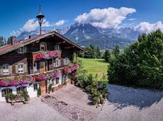
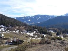
Alpenschlössl-Franzlhof-Village
 recommended
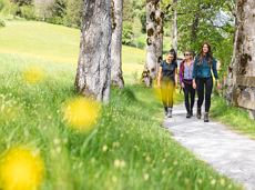
A relaxing hike towards the village center.
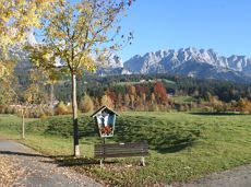
Hiking starting point Alpenschlössl, Söll (762 m)
Hiking starting point Alpenschlössl Söll (762 m)
Hiking
Easy
0:55 h
3,2 km
20 Elevation gain
The tour recommendations listed here are based on the current weather conditions.
However, we would like to point out that the weather and therefore the conditions can change quickly and that every tour is undertaken at your own risk.
recommendedA relaxing hike towards the village center.
Hiking starting point Alpenschlössl, Söll (762 m)
Hiking starting point Alpenschlössl Söll (762 m)
Hiking
Easy
0:55 h
3,2 km
20 Elevation gain
 recommended
Leisurely hike through forest and across meadows to the sunny plateau of Going and back
Hiking starting point Going center (former tourist information Going) (764 m)
Hiking starting point Going center (former tourist information Going) (764 m)
Hiking
Easy
1:15 h
4,1 km
70 Elevation gain
 recommended
Walking tour for refreshment and relaxation close to the village.
Hiking starting point Tourist Info, Scheffau (738 m)
Hiking starting point Tourist Info, Scheffau (738 m)
Hiking
Easy
0:45 h
2,3 km
70 Elevation gain
 recommended
Nice circular hike through Going with visits to numerous chapels.
Hiking starting point Going center (former tourist information Going) (764 m)
Hiking starting point Going center (former tourist information Going) (764 m)
Hiking
Easy
2:45 h
9,3 km
210 Elevation gain
 recommended
Hike along the sunny side along field paths and settlements from Scheffau to Ellmau..
Hiking starting point, Tourismus Info, Scheffau (737 m)
Bus stop Ellmau Bauhof/Dorf, Ellmau (800 m)
Hiking
Easy
1:30 h
5,7 km
100 Elevation gain
 recommended
The viewpoint mountain of the locals, steep and fascinating.
Hiking starting point Alpenschlössl, Söll (762 m)
Hiking starting point Alpenschlössl, Söll (762 m)
Hiking
Intermediate
5:00 h
10,4 km
790 Elevation gain
 recommended
Short hike from Jägerwirt to the Kaiseralm with great mountain views.
Hiking starting point Jägerwirt, Scheffau (883 m)
Hiking starting point Jägerwirt, Scheffau (883 m)
Hiking
Easy
1:45 h
5,0 km
250 Elevation gain
 recommended
Explore Going on the village circular tour and get to knowone or two hidden corners of our quiet, idyllic, artisan village with panoramic views of the Wilder Kaiser from a different angle.
Hiking starting point Going center (former tourist information Going) (764 m)
Hiking starting point Going center (former tourist information Going) (764 m)
Hiking
Easy
1:15 h
4,2 km
60 Elevation gain
 recommended
Explore the districts of Paisslberg and Ried on a leisurely hike for everyone.
Hiking starting point Alpenschlössl, Söll (762 m)
Hiking starting point Alpenschlössl, Söll (762 m)
Hiking
Easy
1:30 h
4,4 km
100 Elevation gain
 recommended
Looping the village of Söll, the sight seeing hike!
Hiking starting point Tourist Info, Söll (689 m)
Hiking starting point Tourist Info, Söll (689 m)
Hiking
Easy
1:00 h
3,7 km
50 Elevation gain
 recommended
A tour of the main filming locations of the TV series “Der Bergdoktor” (The Mountain Doctor) in Ellmau and Going, with a refreshment stop at the inn used during filming
Hiking info point, Tourist Info Ellmau (800 m)
Hiking info point, Tourist Info Ellmau (800 m)
Hiking
Easy
3:15 h
11,4 km
180 Elevation gain
 recommended
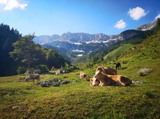
The Sunnseit circuit lives up to its name - this sunny circular hike leads through a varied landscape with fantastic views of Söll, the Wilder Kaiser, the Hohe Salve and the Pölven massif.
Hiking starting point Franzlhof, Söll (703 m)
Hiking starting point Franzlhof, Söll (703 m)
Hiking
Easy
2:15 h
7,3 km
180 Elevation gain
 recommended
Ideal tour for starters and high temperatures.
Hiking starting point Franzlhof, Söll (703 m)
Hiking starting point Franzlhof, Söll (703 m)
Hiking
Easy
0:45 h
2,4 km
50 Elevation gain
 recommended
A tour of the main filming locations of the TV series “Der Bergdoktor” (The Mountain Doctor) in Ellmau, with a refreshment stop at the inn used during filming
Hiking starting point Tourist Info, Ellmau (798 m)
Hiking starting point Tourist Info, Ellmau (798 m)
Hiking
Easy
2:15 h
7,5 km
200 Elevation gain
 recommended
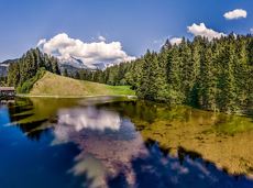
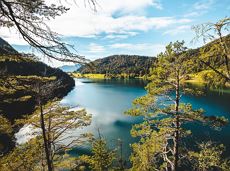
Crystal-clear mountain lake and magnificent views of the Wilder Kaiser’s western summits
Hintersteiner See, Scheffau (890 m)
Hintersteiner See, Scheffau (890 m)
Hiking
Easy
1:30 h
5,2 km
130 Elevation gain
 recommended
Hiking starting point Tourist Info, Scheffau (737 m)
Hiking starting point Tourist Info, Scheffau (737 m)
Hiking
Easy
3:45 h
11,2 km
410 Elevation gain
 recommended
Short tour with varied paths and views
Hiking starting point Tourismus Info, Scheffau (737 m)
Hiking starting point Tourismus Info, Scheffau (737 m)
Hiking
Easy
2:00 h
5,8 km
230 Elevation gain
 recommended
Easy, flat circular path through the sunny village part 'Prama' for walkers families with pushchairs.
Hiking starting point Going center (former tourist information Going) (764 m)
Hiking starting point Going center (former tourist information Going) (764 m)
Hiking
Easy
1:00 h
3,9 km
30 Elevation gain
 recommended
Beautiful hike around the Hintersteiner See lake and to a small alpine village.
Hiking starting point Seestüberl, Scheffau (889 m)
Hiking starting point Seestüberl, Scheffau (889 m)
Hiking
Easy
3:45 h
12,3 km
350 Elevation gain
 recommended
A beautiful easy hike at the foot of the Wilder Kaiser
Hiking starting point Tourist Info, Ellmau (800 m)
Hiking starting point Tourist Info, Ellmau (800 m)
Hiking
Easy
1:45 h
5,9 km
60 Elevation gain
 recommended
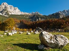
Head through well-shaded forests of green to reach the Ellmau Stone Circle. This is a place with a special energy, making it an inviting option for taking some time to relax.
Hiking starting point Wochenbrunner Alm, Ellmau (1,085 m)
Hiking starting point Wochenbrunner Alm, Ellmau (1,085 m)
Hiking
Intermediate
1:00 h
2,4 km
120 Elevation gain
 recommended
Explore small places with farms, forests and views of the valley between Scheffau and Ellmau.
Hiking starting point Tourist Info, Scheffau (737 m)
Hiking starting point Tourist Info, Scheffau (737 m)
Hiking
Easy
2:45 h
8,5 km
270 Elevation gain

Hike to the Hexenwasser and get rewarded with a view.
Bergbahn valley station, Söll (724 m)
Bergbahn valley station, Söll (724 m)
Hiking
Easy
3:00 h
7,9 km
410 Elevation gain
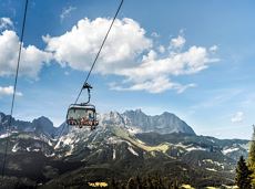
Bike to the Hexenwasser theme park and Hochsöll.
Village Center, Söll (689 m)
Hexenwasser theme park, Hochsöll (1,150 m)
Cycling
Intermediate
5,1 km
480 Elevation gain

The best seat in the house for a view of the Wilder Kaiser!
Tourist Information Office, Going (766 m)
Tourist Information Office, Going (766 m)
Cycling
Intermediate
2:00 h
7,5 km
350 Elevation gain
A scenic circuit past Gieringer Weiher pond, Schwarzsee lake and Going bathing lake.
Tourist Info, Going (764 m)
Tourist Info, Going (764 m)
Cycling
Intermediate
40,1 km
460 Elevation gain
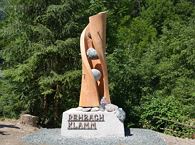
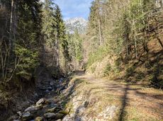
Exciting round trip for adults and children through the Rehbach gorge.
Hiking starting point Tourist Info, Scheffau (738 m)
Hiking starting point Tourist Info, Scheffau (738 m)
Hiking
Intermediate
2:00 h
5,5 km
280 Elevation gain
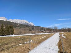
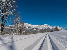
Wonderful winter hike on the sunny side of the valley and easy return to the starting point by bus.
Hiking starting point Tourist Information Office, Ellmau (800 m)
Hiking starting point Tourist Information Office, Scheffau (737 m)
Hiking
Easy
2:15 h
6,1 km
40 Elevation gain
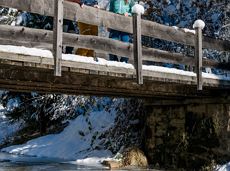
Atmospheric forest walk along the snow-white creek.
Hiking starting point Tourist Info, Scheffau (738 m)
Hiking starting point Tourist Info, Scheffau (738 m)
Hiking
Intermediate
2:00 h
4,2 km
160 Elevation gain
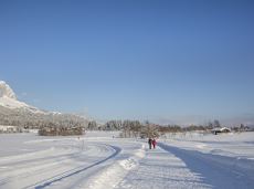
Enjoy winter silence and an imperial panorama in Söll.
parking area Ahornsee, Söll (693 m)
parking area Ahornsee, Söll (693 m)
Cross-country skiing
Intermediate
5,3 km
80 Elevation gain

A beautiful tour around the Kalkstein mountain and Pillersee lake.
Tourist Info, Going (764 m)
Tourist Info, Going (764 m)
Cycling
Intermediate
66,9 km
550 Elevation gain

Short, promising cross-country ski circuit with combination options.
Cross-country skiing
Intermediate
2,2 km
40 Elevation gain
Family roundtrip through the Rebachklamm to the Seilabodenkreuz, via the Kaiseralm and the Jägerwirt back to the center of Scheffau.
Community Hall, Scheffau (740 m)
Community Hall, Scheffau (740 m)
Hiking
Intermediate
3:15 h
9,7 km
510 Elevation gain
Family-friendly, leisurely circular hike around the Astberg mountain
Astberg mountain station, Going (1.251 m)
Astberg mountain station, Going (1.251 m)
Hiking
Easy
0:30 h
1,5 km
80 Elevation gain

The Kaiserkrone Trail is a trail running event with several competitions that lead around the Wilder Kaiser mountain massif. More about the event at: www.kaiserkrone.run
Start & Finish - village center of Scheffau (732 m), address: Dorf 45, 6351 Scheffau
Start & Finish - village center of Scheffau (732 m), address: Dorf 45, 6351 Scheffau
Jogging
Easy
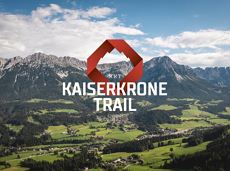
The Kaiserkrone Trail is a trail running event with several competitions that lead around the Wilder Kaiser mountain massif. More about the event at: www.kaiserkrone.run
Start & Finish - village center of Scheffau (732 m), address: Dorf 45, 6351 Scheffau
Start & Finish - village center of Scheffau (732 m), address: Dorf 45, 6351 Scheffau
Jogging
Difficult
56,0 km
3640 Elevation gain
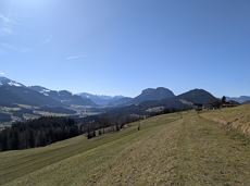
Enjoy unique panoramic views of the impressive mountains from the Biedringer Platte plateau.
Hiking starting point Tourist Info, Ellmau (800 m)
Hiking starting point Tourist Info, Ellmau (800 m)
Hiking
Easy
4:15 h
12,6 km
470 Elevation gain
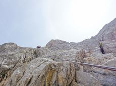
Number of rope lengths4
Access time2,0
Alpine climbing route
Multi-rope length difficulty levels7-
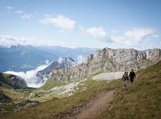
Hikers exploring Tirol on foot will feel as free as a bird. The eagle walk is one of the 'Great Walks' of Tyrol chosen by a jury. They offer hikers the chance to get away from it all, discover the beauty of nature and experience a true adventure in the Alps.
St. Johann in Tirol
Arlbergpass
Hiking
Difficult
413,0 km
31000 Elevation gain
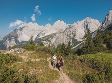
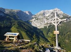
Going, Hüttling – Graspoint-Niederalm – Obere Regalm – Brennender Palven – Gaudeamushütte – Klamml – Gruttenhütte
Hiking starting point Hüttling, Going (820 m)
Gaudeamushütte, Going (1,263 m) / Gruttenhütte, Ellmau (1,620 m)
Hiking
Intermediate
4:30 h
8,0 km
1120 Elevation gain