Hoppala, route niet gevonden

De door u opgevraagde pagina is niet beschikbaar. U bent welkom om een nieuwe zoekopdracht op deze pagina te starten.

0 Routes & tochten

Hartkaiserweg trail Ellmau

Hartkaiserweg trail Ellmau

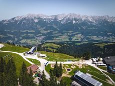
Ellmau village park - Hartkaiserbahn valley station - Bergschenke - Rübezahlalm - Jägerhütte - Hartkaiser summit station

Hiking starting point Tourist Info, Ellmau (800 m)

Hartkaiser summit station, Ellmau (1,555 m)

Hardlopen

Normaal

8,2 km

720 Hoogtemeters

Kaiserkrone - alternative route crossing through the Ellmauer Tor (Eggersteig trail - Jubiläumssteig trail)

Kaiserkrone - alternative route crossing through the Ellmauer Tor (Eggersteig trail - Jubiläumssteig trail)

Stripsenjochhaus – Eggersteig – Steinerne Rinne – Ellmauer Tor – Jubiläumssteig – Gruttenhütte

Stripsenjochhaus, St. Johann in Tirol (1,577 m)

Gaudeamushütte, Going (1,263 m)

Wandelen

Moeilijk

5:00 u

6,3 km

590 Hoogtemeters

Salvenblick hiking round

Salvenblick hiking round

Comfortable round with a magnificent view of the Hohe Salve.

Mountain station gondola Hexenwasser, Söll (1,150 m)

Mountain station gondola Hexenwasser, Söll (1,150 m)

Wandelen

Gemakkelijk

0:35 u

1,8 km

50 Hoogtemeters

Kaiserkrone - stage 4

Kaiserkrone - stage 4

Stripsenjochhaus – Stripsenkopf – Feldberg – Scheibenbichlalmen – Griesenau – Gasteig

Stripsenjochhaus, St. Johann in Tirol (1,577 m)

Gasteig (750 m)

Wandelen

Normaal

6:30 u

16,1 km

640 Hoogtemeters

SkiWelt Panoramic Trail

SkiWelt Panoramic Trail

The highlight for everyone who loves hiking for pleasure - lush Alpine meadows, sparkling mountain lakes and delightful food in the Kitzbühel Alps. And the Bergbahnen Wilder Kaiser - Brixental summer cable cars make the ascent and descent easy.

Astberg, Going

Hochsöll

Wandelen

Gemakkelijk

6:45 u

20,0 km

720 Hoogtemeters

Eagle Walk Stage 01: St. Johann in Tirol - Gaudeamushütte

Eagle Walk Stage 01: St. Johann in Tirol - Gaudeamushütte

Sturdy boots will help keep your ankles and feet happy on this hike, full of the best things Tirol has to offer: well-maintained trails, wildflowers galore and waterfalls beckon the adventurous hiker ready for a strenuous climb with breathtaking views of lofty Wilder Kaiser Mountain Range as your reward. The nature reserve’s landscape will win you over with its diverse beauty. The pasture regions are covered with soft grassy meadows, and hikers are greeted by lofty Wilder Kaiser Mountain Range with rugged Maukspitze, Ackerlspitze, Regalpspitze and Törlspitze Peaks, all “Two-Thousanders” that average 2,000 metres altitude. Trailhead is Rummlerhof Inn, northwest of the village centre of St. Johann. After a successful first segment, why not take a rest at Gaudeamus Hut, raise your glass and sing: “Gaudeamus igitur – Let us be happy!” For many hikers this is far enough, contentment has already set in. Adventurous souls continue on the trail that works its way up across Klamml Gorge to Grutten Hut, which entails another 400 metres of climbing.

Rummlerhof, St.Johann in Tirol

Gaudeamushütte

Wandelen

Normaal

5:00 u

13,0 km

1060 Hoogtemeters

Bichlloipe

Bichlloipe
Bichlloipe
Bichlloipe

Cross-country skiing on an isolated plateau, surrounded by forest and winter meadows.

Langlaufen

Gemakkelijk

1,3 km

30 Hoogtemeters

Koglrunde

Koglrunde
Koglrunde
Koglrunde

Cozy winter tour in Hochsöll with lift support, refreshments and view to the Hohe Salve.
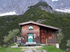
Mountain station gondola Hexenwasser, Söll (1,150 m)

Mountain station gondola Hexenwasser, Söll (1,150 m)

Wandelen

Gemakkelijk

1:30 u

3,2 km

100 Hoogtemeters

Schwendt circuit

Schwendt circuit
Schwendt circuitaanbevolen
Schwendt circuit

Leisurely hike through forest and across meadows to the sunny plateau of Going and back

Hiking starting point Going center (former tourist information Going) (764 m)

Hiking starting point Going center (former tourist information Going) (764 m)

Wandelen

Gemakkelijk

1:15 u

4,1 km

70 Hoogtemeters

MTB-Tour 364 Walleralm

MTB-Tour 364 Walleralm

A short MTB tour to the Walleralm mountain inn, easily combined with other routes.

Parkplatz Pension Maier, Scheffau (925 m)

Parkplatz Walleralm, Söll (685 m)

Fietsen

Normaal

3,3 km

260 Hoogtemeters

Quellen circular route

Quellen circular route

Enjoy the scenic area of the Hohe Salve where the Söll waters originate.

Exit Keat chairlift, Söll (1,533 m)

Exit Keat chairlift, Söll (1,533 m)

Wandelen

Normaal

3:45 u

10,3 km

530 Hoogtemeters

Ackerlhütten circular hike

Ackerlhütten circular hike

Intermediate circular hike with breathtaking views on the surrounding mountains. Attention: Trail no 828 is closed due to danger of falling rocks. Detour via path no. 816 and 827 via the Obere Regalm to the Baumgartenköpfl.

Hiking starting point Tannbichl, Going (857 m)

Hiking starting point Tannbichl, Going (857 m)

Wandelen

Normaal

4:45 u

9,8 km

760 Hoogtemeters