


 Deutsch
 English
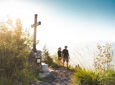
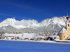
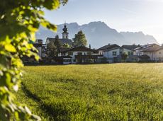
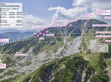
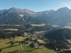
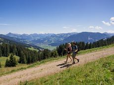
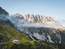
Kleiner Pölven summit from Franzlhof

The panoramic spot of the locals, steep and fascinating.
Hiking starting point Franzlhof, Söll (703 m)
Hiking starting point Franzlhof, Söll (703 m)
Wandelen
Normaal
5:00 u
8,5 km
880 Hoogtemeters
De door u opgevraagde pagina is niet beschikbaar. U bent welkom om een nieuwe zoekopdracht op deze pagina te starten.
The panoramic spot of the locals, steep and fascinating.
Hiking starting point Franzlhof, Söll (703 m)
Hiking starting point Franzlhof, Söll (703 m)
Wandelen
Normaal
5:00 u
8,5 km
880 Hoogtemeters

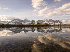
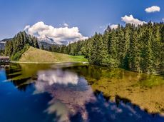
Pleasant circular hiking trail through forests and meadows to the romantically situated moor lake.
Hiking starting point Franzlhof, Söll (703 m)
Hiking starting point Franzlhof, Söll (703 m)
Wandelen
Normaal
2:00 u
5,7 km
240 Hoogtemeters
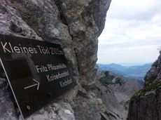
Demanding mountain tour to the Kleines Törl pass, the little "brother" of the Ellmauer Tor in the Ostkaiser.
Hiking starting point Tannbichl, Going (855 m)
Hiking starting point Tannbichl, Going (855 m)
Wandelen
Moeilijk
8:00 u
12,0 km
1260 Hoogtemeters

Nice circular hike through Going with visits to numerous chapels.
Hiking starting point Going center (former tourist information Going) (764 m)
Hiking starting point Going center (former tourist information Going) (764 m)
Wandelen
Gemakkelijk
2:45 u
9,3 km
210 Hoogtemeters
Gasteig – Wilder-Kaiser-Steig – Ursulablick – Gscheuerkopf – Graspoint-Hochalm – Graspoint-Niederalm – Going, Hüttling
Gasteig (750 m)
Hiking starting point Hüttling, Going (820 m)
Wandelen
Normaal
5:15 u
10,8 km
840 Hoogtemeters
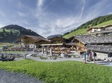
Experience culinaric highlights for the whole family.
Bergstation Rabennest (1.150 m)
Bergstation Rabennest (1.150 m)
Wandelen
Gemakkelijk
0:40 u
1,7 km
90 Hoogtemeters
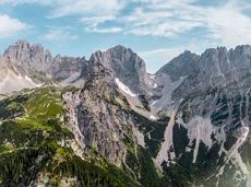
Going, Hüttling - Schleierwasserfall - Obere Regalm - Baumgartenköpfl (Bergsteigergrab) - Gaudeamushütte - Ellmauer Tor - Hintere Goinger Halt - Jubiläumssteig - Gruttenhütte - Kaiser-Hochalm - Steiner-Hochalm - Hinterschießling Alm - Rehbachklamm - Scheffau, Dorf
Hiking starting point Hüttling, Going (820 m)
Scheffau village (738 m)
Wandelen
Moeilijk
14:00 u
24,6 km
2060 Hoogtemeters
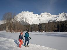
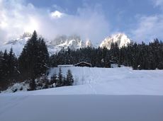
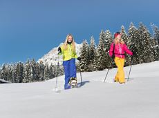
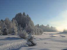
Savour the wonder of the winter landscape – experience the winter magic for yourself by crunching through the pristine snow with your snowshoes. Enjoy unique impressions and experiences as you explore the white winter splendour and take in the spectacular view over the surrounding mountain scenery.
Church square, Going (769 m)
Church square, Going (769 m)
Wandelen
1:30 u
2,9 km
110 Hoogtemeters
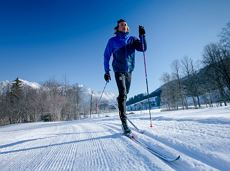
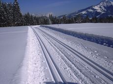
A classic style trail connects the villages of Söll and Scheffau for cross-country skiing in winter.
Parkplatz Ahornsee, Söll (693 m)
village, Scheffau
Langlaufen
Normaal
5,5 km
65 Hoogtemeters
Picturesque circular hiking trail on the sunny side of Going in unspoilt nature - over snow fields with fantastic views of Going aht the Wilder Kaiser.
Hiking starting point Going center (former tourist information Going) (764 m)
Hiking starting point Going center (former tourist information Going) (764 m)
Wandelen
1:45 u
4,8 km
80 Hoogtemeters
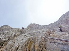
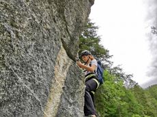
Alpine klimroutes
Ancient path of the romans - a better stroll.
Hiking starting point Tourist Info, Söll (689 m)
Hiking starting point Tourist Info, Söll (689 m)
Wandelen
Gemakkelijk
1:00 u
3,0 km
55 Hoogtemeters

Past inn, farm and chapel in the Kaiser countryside.
Hiking starting point Going Center (former Tourist informatin Going)
Hiking starting point Going Center (former Tourist informatin Going)
Langlaufen
Gemakkelijk
1,2 km
10 Hoogtemeters
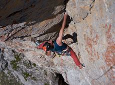
Alpine klimroutes
Atmospheric winter hike right into the Wilder Kaiser.
Bathing lake, Going (742 m)
Graspoint-Niederalm, Going (981 m)
Wandelen
2:30 u
5,7 km
250 Hoogtemeters

Ellmau village park - Hartkaiserbahn valley station - Bergschenke - Rübezahlalm - Jägerhütte - Hartkaiser summit station
Hiking starting point Tourist Info, Ellmau (800 m)
Hartkaiser summit station, Ellmau (1,555 m)
Hardlopen
Normaal
8,2 km
720 Hoogtemeters
Across snow-covered meadows along the Going 'sunny side' (Sonnseite).
Bathing lake, Going (742 m)
Bathing lake, Going (742 m)
Wandelen
1:30 u
3,9 km
60 Hoogtemeters
 Open
OpenVia ferrata
A beautiful tour up to the Astberg lake via the Hollenauer Kreuz with fantastic views
Astbergbahn valley station, Going (805 m)
Astbergsee, Going (1.251m)
Wandelen
Gemakkelijk
3,0 km
465 Hoogtemeters
Peace and strength, slow down and take a deep breath.
Ahornsee car park, Söll (693 m)
Ahornsee car park, Söll (693 m)
Wandelen
4:45 u
12,0 km
220 Hoogtemeters
Easy snowshoe hike at the foot of the Wilder Kaiser.
Postbus stop Dorf/Bauhof, Ellmau
Postbus stop Dorf/Bauhof, Ellmau
Wandelen
0:40 u
1,3 km
10 Hoogtemeters
Round tour through Scheffau with panoramic views, refreshment by the stream and slowing down in the forest.
Hiking starting point Tourist Info, Scheffau (738 m)
Hiking starting point Tourist Info, Scheffau (738 m)
Wandelen
Gemakkelijk
1:15 u
4,3 km
90 Hoogtemeters
Langlaufen
Gemakkelijk
1,0 km
Hiking starting point Tourist Info, Scheffau (737 m)
Hiking starting point Tourist Info, Scheffau (737 m)
Wandelen
Gemakkelijk
3:45 u
11,2 km
410 Hoogtemeters
Hike from the centre of Ellmau, along trail no. 14, through the "Spatlahner gorge" up to the Wochenbrunner Alm.
Hiking starting point Tourist Info, Ellmau (800 m)
Hiking starting point Tourist Info, Ellmau (800 m)
Wandelen
Gemakkelijk
1:30 u
4,4 km
285 Hoogtemeters
A leisurely circular trail along the sunny side of Ellmau. This is a lovely walk along the picturesque Kaiserloipe with views of the majestic mountains. An easy hike for the whole family.
Hiking starting point Tourist Info, Ellmau (800 m)
Hiking starting point Tourist Info, Ellmau (800 m)
Wandelen
2:00 u
5,8 km
50 Hoogtemeters
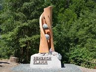
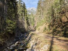
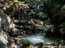
Exciting round trip for adults and children through the Rehbach gorge.
Hiking starting point Tourist Info, Scheffau (738 m)
Hiking starting point Tourist Info, Scheffau (738 m)
Wandelen
Normaal
2:00 u
5,5 km
280 Hoogtemeters
A relaxing hike towards the village center.
Hiking starting point Alpenschlössl, Söll (762 m)
Hiking starting point Alpenschlössl Söll (762 m)
Wandelen
Gemakkelijk
0:55 u
3,2 km
20 Hoogtemeters
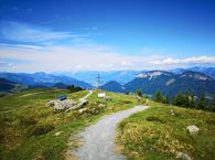
The circuit around Going is a lengthy and demanding tour with a great variety of different sections.
Tourist Information Office, Going (766 m)
Tourist Information Office, Going (766 m)
Hardlopen
Normaal
1:25 u
11,2 km
280 Hoogtemeters
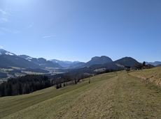
Enjoy the scenic area of the Hohe Salve where the Söll waters originate.
Exit Keat chairlift, Söll (1,533 m)
Exit Keat chairlift, Söll (1,533 m)
Wandelen
Normaal
3:45 u
10,3 km
530 Hoogtemeters

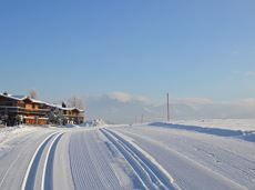
Skiing or hiking on the cross-country trail isn’t possible when there’s been too little snow on the sunny side. In this case there’s a perfectly prepared trail available on the shaded side - the Dorfloipe Going.
Infobüro Going,
Wanderstartplatz Infobüro, Going (764 m)
Langlaufen
Gemakkelijk
1,4 km
20 Hoogtemeters
 Open
OpenVia ferrata
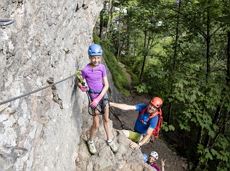 Open
OpenVia ferrata
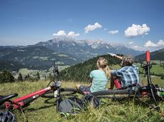
A challenging circular mountainbike tour with plenty of welcoming refreshment stops.
Village Center, Söll (703 m)
Village Center, Söll (703 m)
Fietsen
Normaal
28,5 km
950 Hoogtemeters
Hike to the Gruttenhütte with great views to the Ellmauer Halt and the entire region.
Hiking starting point Tourist Info, Scheffau (738 m)
Gruttenhütte, Ellmau (1,620 m)
Wandelen
Normaal
6:30 u
16,4 km
990 Hoogtemeters
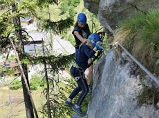 Open
OpenVia ferrata
Short tour with varied paths and views
Hiking starting point Tourismus Info, Scheffau (737 m)
Hiking starting point Tourismus Info, Scheffau (737 m)
Wandelen
Gemakkelijk
2:00 u
5,8 km
230 Hoogtemeters
A walk that lets you experience the Brandstadl mountain and leads you to Jochstubnsee lake.
Brandstadlbahn valley station, Scheffau (681 m)
Brandstadlbahn valley station, Scheffau (681 m)
Wandelen
Gemakkelijk
4:45 u
12,7 km
1130 Hoogtemeters

Alpine klimroutes
Ideal tour for starters and high temperatures.
Hiking starting point Franzlhof, Söll (703 m)
Hiking starting point Franzlhof, Söll (703 m)
Wandelen
Gemakkelijk
0:45 u
2,4 km
50 Hoogtemeters