Restaurant Franzlhof

Vandaag geopend

14:00 - 22:00 Uur

Dorfbichl 37, Söll

Beschrijving

Culinary Highlight

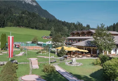
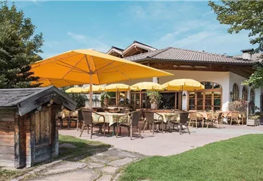
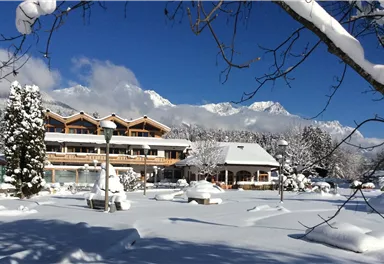
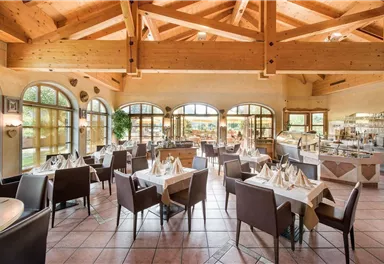
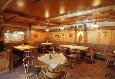
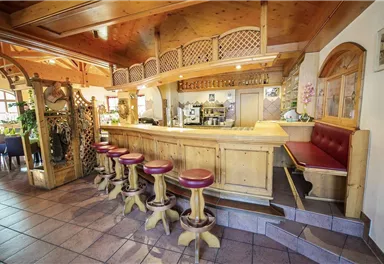
The Franzlhof is located on a sunny plateau with a wonderful view of the Hohe Salve and the Wilder Kaiser. Tyrolean hospitality, a sense of family and a loving eye for the fine details run in the Mödlinger family's blood.

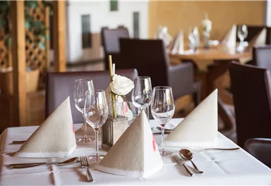
In the café and restaurant, guests indulge in the pleasures of Tyrolean cuisine. Both homemade cake specialties and delicious ice cream made from own organic milk, as well as fine delicacies and dishes can be enjoyed in a cozy atmosphere.

Quality is particularly important, which is why organic products from our own farm are used for the traditional dishes.

Toon meer

Contactgegevens

Restaurant FranzlhofDorfbichl 376306 Söll(0043) 5333 5117info@franzlhof.comwww.franzlhof.com

Naar de plattegrond

Gekoppelde verhuurders

Via deze tochten
bereik je ons

Schattseittrail

Schattseittrail
Schattseittrail
Schattseittrail

Tourismus Info, Söll

Tourismus Info, Söll

12,8 km

The Schattseit trail, mystical and refreshing in equal measure, is a section of the infamous Kaisermarathon, probably the toughest mountain marathon in the Alps.

Hardlopen

Gemakkelijk

330 Hoogtemeters

Pölven circular route

Pölven circular route

Hiking starting point Franzlhof, Söll (703 m)

Hiking starting point Franzlhof, Söll (703 m)

17,8 km

A circuit around the mountain that the locals love for its great view.

Wandelen

Normaal

6:00 u

670 Hoogtemeters

War memorial circular route

War memorial circular route

Hiking starting point Tourist Info, Söll (689 m)

Hiking starting point Tourist Info, Söll (689 m)

2,1 km

This pleasant circular walk takes you to Söll’s war memorial in a beautiful section of forest.

Wandelen

Gemakkelijk

0:30 u

10 Hoogtemeters

Koller circular route

Koller circular route

Hiking starting point Tourist Info, Söll (689 m)

Hiking starting point Tourist Info, Söll (689 m)

3,0 km

Ancient path of the romans - a better stroll.

Wandelen

Gemakkelijk

1:00 u

55 Hoogtemeters

Söller village tour

Söller village tour
Söller village tour
Söller village tour

Hiking starting point Tourist Info, Söll (689 m)

Hiking starting point Tourist Info, Söll (689 m)

3,7 km

Looping the village of Söll, the sight seeing hike!

Wandelen

Gemakkelijk

1:00 u

50 Hoogtemeters

Pölvenau circular route

Pölvenau circular route

Hiking starting point Franzlhof, Söll (703 m)

Hiking starting point Franzlhof, Söll (703 m)

5,7 km

Pleasant circular hiking trail through forests and meadows to the romantically situated moor lake.

Wandelen

Normaal

2:00 u

240 Hoogtemeters