


 Deutsch
 English
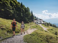
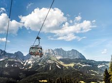
MTB Tour Kathen Circuit
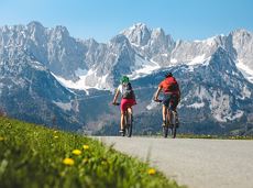
A moderately challenging panoramic circuit around the Astberg mountain.
Tourist Info, Going (764 m)
Tourist Info, Going (764 m)
Fietsen
Normaal
15,3 km
480 Hoogtemeters
De door u opgevraagde pagina is niet beschikbaar. U bent welkom om een nieuwe zoekopdracht op deze pagina te starten.
A moderately challenging panoramic circuit around the Astberg mountain.
Tourist Info, Going (764 m)
Tourist Info, Going (764 m)
Fietsen
Normaal
15,3 km
480 Hoogtemeters

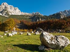
This stage takes hikers to the small town of Kufstein located on the banks of the Inn river – a town which has been celebrated in song and is steeped in history and character. Walkers make their way through the lush and verdant beauty of a pasture paradise with cosy huts and mountain restaurants before stopping for a rest at the Brentenjochhütte hut (delicious “Kiachl” are served every Saturday). With so many sights to marvel at, don't forget to keep an eye out for the nearly one thousand species of flowering plants native to the Kaiser Mountains.
Hintersteiner See
Kufstein
Wandelen
Normaal
4:00 u
12,5 km
160 Hoogtemeters
 aanbevolen
A beautiful easy hike at the foot of the Wilder Kaiser
Hiking starting point Tourist Info, Ellmau (800 m)
Hiking starting point Tourist Info, Ellmau (800 m)
Wandelen
Gemakkelijk
1:45 u
5,9 km
60 Hoogtemeters
 aanbevolen
Head through well-shaded forests of green to reach the Ellmau Stone Circle. This is a place with a special energy, making it an inviting option for taking some time to relax.
Hiking starting point Wochenbrunner Alm, Ellmau (1,085 m)
Hiking starting point Wochenbrunner Alm, Ellmau (1,085 m)
Wandelen
Normaal
1:00 u
2,4 km
120 Hoogtemeters
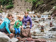
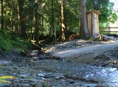
Hikers, young and old alike, will find in this wild romantic gorge natural playgrounds such as bridges and balancing beams by streams and ponds.
Hiking starting point Tourist Info, Scheffau (738 m)
Hiking starting point Tourist Info, Scheffau (738 m)
Wandelen
Gemakkelijk
1:15 u
3,5 km
130 Hoogtemeters

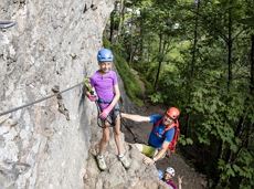
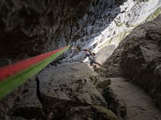
This is a very well secured sport climbing route in excellent rock conditions.
Alpine klimroutes

The varied loop takes you on leisurely valley cycle paths as well as a mountain evaluation on the MTB routes 265 and 350 once around the Hohe Salve lookout mountain.
Tourismus Info, Söll
Tour
Fietsen
Normaal
36,5 km
880 Hoogtemeters
A varied tour with impressive views and refreshment stops.
Hiking starting point Wochenbrunner Alm, Ellmau (1.085 m)
Hiking starting point Wochenbrunner Alm, Ellmau (1.085 m)
Wandelen
Normaal
1:30 u
3,2 km
220 Hoogtemeters
Overview of all competition routes of the Trailrunning Event "Kaiserkrone Trail". More about the event at: www.kaiserkrone.run
Event area - village center of Scheffau (732 m), address: Dorf 45, 6351 Scheffau
Event area - village center of Scheffau (732 m), address: Dorf 45, 6351 Scheffau
Hardlopen
Following the Stampfangerbach stream on the way to Filzalm lake
Hiking starting point Bergbahn, Söll (725 m)
Hiking starting point Bergbahn, Söll (725 m)
Wandelen
Normaal
3:15 u
9,0 km
620 Hoogtemeters
 aanbevolen
A tour of the main filming locations of the TV series “Der Bergdoktor” (The Mountain Doctor) in Ellmau, with a refreshment stop at the inn used during filming
Hiking starting point Tourist Info, Ellmau (798 m)
Hiking starting point Tourist Info, Ellmau (798 m)
Wandelen
Gemakkelijk
2:15 u
7,5 km
200 Hoogtemeters

Alpine klimroutes
Ellmau Tourist Information Office - golf course - Wochenbrunner Alm
Tourist Information Office, Ellmau (800 m)
Wochenbrunner Alm, Ellmau (1,085 m)
Fietsen
Normaal
4,8 km
260 Hoogtemeters
Gaudeamushütte - Ellmauer Tor - Klammlweg - Gruttenhütte
Gaudeamushütte, Going (1,263 m)
Gruttenhütte, Ellmau (1,620 m)
Wandelen
Normaal
4:45 u
5,9 km
990 Hoogtemeters
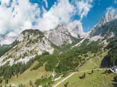
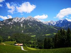
The panoramic Scheffauer is the last high peak in the west at 2,111 m above sea level.
Hiking starting point Bärnstatt, Scheffau (920 m)
Hiking starting point Bärnstatt, Scheffau (920 m)
Wandelen
Moeilijk
7:00 u
7,9 km
1180 Hoogtemeters
 aanbevolen
Hike along the sunny side along field paths and settlements from Scheffau to Ellmau..
Hiking starting point, Tourismus Info, Scheffau (737 m)
Bus stop Ellmau Bauhof/Dorf, Ellmau (800 m)
Wandelen
Gemakkelijk
1:30 u
5,7 km
100 Hoogtemeters

This easy family hike takes you via the Bergdoktorhaus to the Berggasthof Hochschwendt mountain inn.
Wanderstartplatz Tourist Info, Ellmau (800m)
Wanderstartplatz Tourist Info, Ellmau (800m)
Wandelen
Gemakkelijk
2:45 u
8,7 km
270 Hoogtemeters
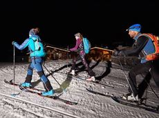
Langlaufen
Gemakkelijk
1,0 km
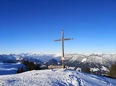
Family-friendly, leisurely circular hike around the Astberg mountain
Astberg mountain station, Going (1.251 m)
Astberg mountain station, Going (1.251 m)
Wandelen
Gemakkelijk
0:30 u
1,5 km
80 Hoogtemeters
Explore the popular path past the TV backdrop on snowshoes.
Cable car valley station, Söll (725 m)
Cable car valley station, Söll (725 m)
Wandelen
4:45 u
7,0 km
350 Hoogtemeters
 aanbevolen
Looping the village of Söll, the sight seeing hike!
Hiking starting point Tourist Info, Söll (689 m)
Hiking starting point Tourist Info, Söll (689 m)
Wandelen
Gemakkelijk
1:00 u
3,7 km
50 Hoogtemeters

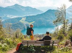
Is it about the journey or the destination? Well, one of the destinations of this stage is definitely the Hintersteiner See lake and its views. Surrounded by stunning mountain vistas, dwarf pine scrubland and beech forests, the lake is one of the cleanest and most beautiful mountain lakes in Tirol. The private pristine gem covers 56 hectares and measures 36 metres at its deepest point. With this picture-perfect backdrop, hikers will complete the remaining distance to the Kaindlhütte hut in no time.
Gaudeamushütte
Hintersteiner See
Wandelen
Normaal
6:30 u
15,1 km
888 Hoogtemeters
 Open
OpenVia ferrata
Short circular walk at the snow-white Brandstadl mountain with panorama view.
Brandstadlbahn summit station, Scheffau (1,643 m)
Brandstadlbahn summit station, Scheffau (1,643 m)
Wandelen
0:30 u
1,3 km
40 Hoogtemeters
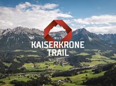
The Kaiserkrone Trail is a trail running event with several competitions that lead around the Wilder Kaiser mountain massif. More about the event at: www.kaiserkrone.run
Start & Finish - village center of Scheffau (732 m), address: Dorf 45, 6351 Scheffau
Start & Finish - village center of Scheffau (732 m), address: Dorf 45, 6351 Scheffau
Hardlopen
Moeilijk
24,7 km
2690 Hoogtemeters
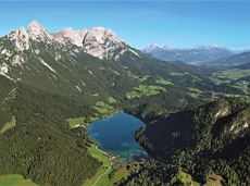
A picturesque mountain hike that leads from the turquoise waters of the most beautiful mountain lake in Tirol up to the rustic Alpine village.
Hiking starting point Seestüberl, Scheffau (890 m)
Hiking starting point Seestüberl, Scheffau (890 m)
Wandelen
Normaal
3:15 u
9,3 km
360 Hoogtemeters
 aanbevolen
Easy, flat circular path through the sunny village part 'Prama' for walkers families with pushchairs.
Hiking starting point Going center (former tourist information Going) (764 m)
Hiking starting point Going center (former tourist information Going) (764 m)
Wandelen
Gemakkelijk
1:00 u
3,9 km
30 Hoogtemeters
 Gesloten
Moderately difficult ascent route along the ski route 80c/d to the Hartkaiser.
Hartkaiserbahn valley station, Ellmau (824 m)
Hartkaiserbahn mountain station, Ellmau (1.524 m)
Skitocht
Normaal
2:30 u
4,2 km
700 Hoogtemeters
Gruttenhütte - Kaiser-Hochalm - Steiner-Hochalm - Jägersteig - Walleralm - Hochegg - Kaindlhütte
Gruttenhütte, Ellmau (1,620 m)
Hintersteiner See, Scheffau (889 m)
Wandelen
Normaal
5:30 u
13,5 km
560 Hoogtemeters

Sports ground, Söll (687 m)
Sports ground, Söll (687 m)
Hardlopen
Gemakkelijk
8,0 km
100 Hoogtemeters
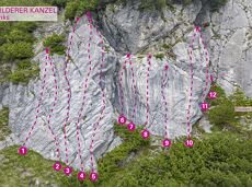
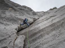
34 magnificent routes with a fantastic panoramic view of the summits.
Sportklimmen
A hike on varied paths around the Achleitberg.
Hiking starting point Tourist Info, Scheffau (738 m)
Hiking starting point Tourist Info, Scheffau (738 m)
Wandelen
Normaal
5:45 u
18,0 km
540 Hoogtemeters
Quietness, strength and with easy breathing steadily closer to the Wilder Kaiser. You can return on foot or by bus.
Hiking starting point Bergbahn, Söll (724 m)
Gasthof Bocking, Söll (665 m)
Wandelen
Gemakkelijk
1:45 u
5,5 km
100 Hoogtemeters
The heart of the tour is the deep, wonderful-to-climb chimney, which lends the tour an Alpine character.
Alpine klimroutes
 Open
OpenAttention! There is an increased risk of slipping on the ascents and descents due to snow fields! Walk at your own risk! The classic on the Steinplatte Waidring was rehabilitated in June 2023 and is a treat for via ferrata fans! The via ferrata "s'Schuastagangl" (C/D) offers wonderful panoramic views, crisp ascents and unforgettable mountain moments. The varied tour leads through steep rock faces and slippery passages up to the summit of the Waidringer Steinplatte (1,848m). Strength for steeper ascents and courage for ladder passages and the "Knieschloderer" variant with airy steps and a rope bridge are required!
Via ferrata
Alpine klimroutes

The Kaiserkrone Trail is a trail running event with several competitions that lead around the Wilder Kaiser mountain massif. More about the event at: www.kaiserkrone.run
Start & Finish - village center of Scheffau (732 m), address: Dorf 45, 6351 Scheffau
Start & Finish - village center of Scheffau (732 m), address: Dorf 45, 6351 Scheffau
Hardlopen
Gemakkelijk

An extensive exploration of the “Moor & more”. Exciting puzzle tour with Rocky through the Kaiserwald forest is sure to be lots of fun, even for older children.
Hiking starting point Hüttling, Going (820 m)
Hiking starting point Hüttling, Going (820 m)
Wandelen
Gemakkelijk
3:00 u
8,0 km
380 Hoogtemeters
Cozy winter tour in Hochsöll with lift support, refreshments and view to the Hohe Salve.
Mountain station gondola Hexenwasser, Söll (1,150 m)
Mountain station gondola Hexenwasser, Söll (1,150 m)
Wandelen
1:30 u
3,2 km
100 Hoogtemeters
Over hill and dale through idyllic nature up to the Rauhen Kopf.
Astberg Bergstation
Astberg Bergstation
Wandelen
Normaal
4:45 u
13,1 km
620 Hoogtemeters