


 Deutsch
 English
Drei-Käse-Hochtour route
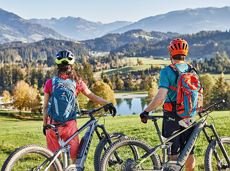
There are 3 steep rises which are moderable with e-bikes.
Cable car valley station, Söll (725 m)
Au Hoch-Alm, Söll (1.600 m)
Fietsen
Normaal
8,9 km
860 Hoogtemeters
De door u opgevraagde pagina is niet beschikbaar. U bent welkom om een nieuwe zoekopdracht op deze pagina te starten.
There are 3 steep rises which are moderable with e-bikes.
Cable car valley station, Söll (725 m)
Au Hoch-Alm, Söll (1.600 m)
Fietsen
Normaal
8,9 km
860 Hoogtemeters
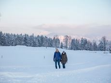
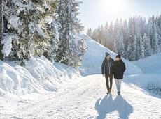
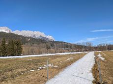
Peace and strength, slow down and take a deep breath.
Ahornsee car park, Söll (693 m)
Ahornsee car park, Söll (693 m)
Wandelen
4:45 u
12,0 km
220 Hoogtemeters
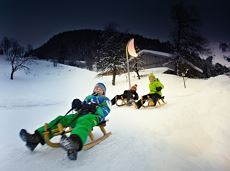
Exciting adventure stations for family tobogganing on the Hohe Salve.
Cable car valley station, Söll (725 m)
Cable car valley station, Söll (725 m)
Rodelen
Gemakkelijk
4,0 km

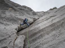
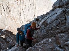
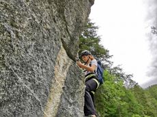
Beautiful, Alpine sport climbing with consistent difficulty.
Alpine klimroutes
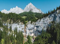
Wilder Kaiser hike to a series of special locations. Featuring the natural spectacle of the Schleier Waterfall and a view of the Gaudeamushütte mountain hut.
Hüttling, Going (820 m)
Hüttling, Going (820 m)
Wandelen
Normaal
6:00 u
13,6 km
980 Hoogtemeters

Explore the sunny foot of the Pölven mountain.
Hiking starting point Franzlhof, Söll (703 m)
Hiking starting point Franzlhof, Söll (703 m)
Wandelen
2:30 u
6,8 km
100 Hoogtemeters
 Gesloten
Moderately difficult ascent route along the ski route 80c/d to the Hartkaiser.
Hartkaiserbahn valley station, Ellmau (824 m)
Hartkaiserbahn mountain station, Ellmau (1.524 m)
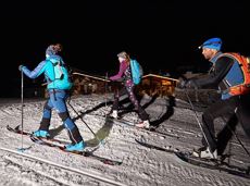
Skitocht
Normaal
2:30 u
4,2 km
700 Hoogtemeters
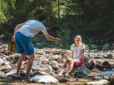
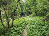
Refreshing walk through the Kneipp circuit and adventures in the Rehbachklamm gorge
Hiking starting point Tourist Info, Scheffau (738 m)
Hiking starting point Tourist Info, Scheffau (738 m)
Wandelen
Normaal
2:00 u
7,1 km
330 Hoogtemeters

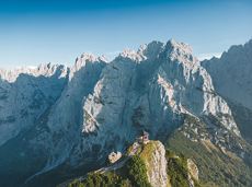
Alpine klimroutes
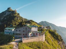
Stripsenjochhaus – Eggersteig – Steinerne Rinne – Ellmauer Tor – Jubiläumssteig – Gruttenhütte
Stripsenjochhaus, St. Johann in Tirol (1,577 m)
Gaudeamushütte, Going (1,263 m)
Wandelen
Moeilijk
5:00 u
6,3 km
590 Hoogtemeters
Turnoff to Granderalm – Schleier Waterfall – Going, Hüttling
First turnoff after the Granderalm
Hiking starting point Hüttling, Going (820 m)
Wandelen
Normaal
2:00 u
3,1 km
40 Hoogtemeters
 Open
OpenVia ferrata

The panoramic spot of the locals, steep and fascinating.
Hiking starting point Franzlhof, Söll (703 m)
Hiking starting point Franzlhof, Söll (703 m)
Wandelen
Normaal
5:00 u
8,5 km
880 Hoogtemeters

Challenging adventure hike to the Ellmauer Tor
Hiking starting point Wochenbrunner Alm, Ellmau (1,085 m)
Ellmauer Tor, Ellmau (2,001 m)
Wandelen
Normaal
5:00 u
7,7 km
900 Hoogtemeters
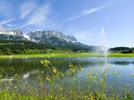
A beautiful tour up to the Astberg lake via the Hollenauer Kreuz with fantastic views
Astbergbahn valley station, Going (805 m)
Astbergsee, Going (1.251m)
Wandelen
Gemakkelijk
3,0 km
465 Hoogtemeters
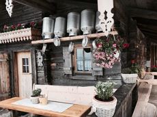
Experience culinaric highlights for the whole family.
Bergstation Rabennest (1.150 m)
Bergstation Rabennest (1.150 m)
Wandelen
Gemakkelijk
0:40 u
1,7 km
90 Hoogtemeters
Ellmau Tourist Information Office - football pitch - Ellmauer Hof - KaiserBad - Hausbach farms - Ellmau Tourist Information Office
Tourist Information Office, Ellmau (820 m)
Tourist Information Office, Ellmau (820 m)
Fietsen
Gemakkelijk
8,2 km
110 Hoogtemeters
Off the beaten track up to the Köpfing farmhouse. “Der Bergdoktor” (The Mountain Doctor) is a famous German-Austrian TV series, which is produced in the Wilder Kaiser region.
Bergdoktor parking lot, Söll
Bergdoktor parking lot, Söll
Wandelen
Gemakkelijk
3:00 u
8,4 km
370 Hoogtemeters
Hike via four mountain huts Rübezahl-Alm, Jägerhütte and Hochschwendt.
Hiking starting point Tourist Info, Ellmau (800 m)
Hiking starting point Tourist Info, Ellmau (800 m)
Wandelen
6:15 u
14,0 km
600 Hoogtemeters
Explore the sunny foot of the Pölven mountain.
Langlaufen
Gemakkelijk
0,9 km
Stripsenjochhaus – Stripsenkopf – Feldberg – Scheibenbichlalmen – Griesenau – Gasteig
Stripsenjochhaus, St. Johann in Tirol (1,577 m)
Gasteig (750 m)
Wandelen
Normaal
6:30 u
16,1 km
640 Hoogtemeters
Alpine klimroutes

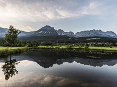
A beautiful tour around the Kalkstein mountain and Pillersee lake.
Tourist Info, Going (764 m)
Tourist Info, Going (764 m)
Fietsen
Normaal
66,9 km
550 Hoogtemeters
 aanbevolen
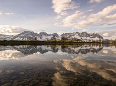
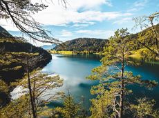
Crystal-clear mountain lake and magnificent views of the Wilder Kaiser’s western summits
Hintersteiner See, Scheffau (890 m)
Hintersteiner See, Scheffau (890 m)
Wandelen
Gemakkelijk
1:30 u
5,2 km
130 Hoogtemeters
Gaudeamushütte - Ellmauer Tor - Hintere Goinger Halt - Jubiläumssteig - Gruttenhütte
Gaudeamushütte, Going (1,263 m)
Gruttenhütte, Ellmau (1,620 m)
Wandelen
Moeilijk
5:30 u
5,9 km
1010 Hoogtemeters
"Enjoyable" winter hike with a cozy stop and a fantastic panorama.
Hiking starting point Tourist Info, Ellmau (800 m)
Hiking starting point Tourist Info, Ellmau (800 m)
Wandelen
4:30 u
10,5 km
370 Hoogtemeters
Short hike to the waterfall in the Breuergraben along the Schwarzache.
Brandstadlbahn valley station, Scheffau (681 m)
Brandstadlbahn valley station, Scheffau (681 m)
Wandelen
Gemakkelijk
1:00 u
3,0 km
150 Hoogtemeters
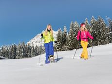
Easy snowshoe hike at the foot of the Wilder Kaiser.
Postbus stop Dorf/Bauhof, Ellmau
Postbus stop Dorf/Bauhof, Ellmau
Wandelen
0:40 u
1,3 km
10 Hoogtemeters
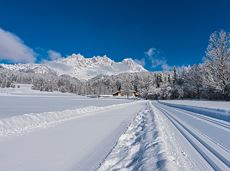
Along the Going Sonnseite where you can breathe in fresh winter air.
Bathing lake, Going (742 m)
Bathing lake, Going (742 m)
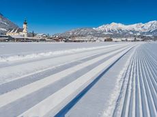
Langlaufen
Normaal
7,7 km
110 Hoogtemeters

The varied loop takes you on leisurely valley cycle paths as well as a mountain evaluation on the MTB routes 265 and 350 once around the Hohe Salve lookout mountain.
Tourismus Info, Söll
Tour
Fietsen
Normaal
36,5 km
880 Hoogtemeters
Experience the picturesque beauty of a section of the Lengau Reflection Trail, which takes you along a steep route to the famous Söller Sunnseitweg.
Wanderstartplatz
Wanderstartplatz Alpenschlössl, Söll (762 m)
Wandelen
Normaal
2:15 u
5,7 km
340 Hoogtemeters

Short, promising cross-country ski circuit with combination options.
Langlaufen
Normaal
2,2 km
40 Hoogtemeters
By bike through the culinary region Wilder Kaiser.
anywhere along the tour
anywhere along the tour
Fietsen
Normaal
38,3 km
560 Hoogtemeters

Wild and free - 5 days of hiking on old paths around the Wilder Kaiser The five-day hike from hut to hut is one of the most beautiful multi-day circular tours in Tirol. It takes mountain walkers along a route of around 58 kilometres, featuring ascents and descents with a difference in altitude of approximately 4,000 metres as they circle around the imposing Wilder Kaiser massif.
Hiking starting point Hüttling, Going (820 m)
Hiking starting point Hüttling, Going (820 m)
Wandelen
Normaal
27 u
57,7 km
4000 Hoogtemeters

An extensive exploration of the “Moor & more”. Exciting puzzle tour with Rocky through the Kaiserwald forest is sure to be lots of fun, even for older children.
Hiking starting point Hüttling, Going (820 m)
Hiking starting point Hüttling, Going (820 m)
Wandelen
Gemakkelijk
3:00 u
8,0 km
380 Hoogtemeters
A scenic circuit past Gieringer Weiher pond, Schwarzsee lake and Going bathing lake.
Tourist Info, Going (764 m)
Tourist Info, Going (764 m)
Fietsen
Normaal
40,1 km
460 Hoogtemeters
 aanbevolen
Hike along the sunny side along field paths and settlements from Scheffau to Ellmau..
Hiking starting point, Tourismus Info, Scheffau (737 m)
Bus stop Ellmau Bauhof/Dorf, Ellmau (800 m)
Wandelen
Gemakkelijk
1:30 u
5,7 km
100 Hoogtemeters
 Open
OpenVia ferrata
Gentle walking or running course in Ellmau
Hiking starting point Tourist Info, Ellmau (800 m)
Hiking starting point Tourist Info, Ellmau (800 m)
Hardlopen
Gemakkelijk
0:20 u
3,0 km
54 Hoogtemeters
Short and easy circuit for beginners right next to the village of Söll.
Brunnhof field Söll
Brunnhof field Söll
Langlaufen
Gemakkelijk
0,9 km