Hoppala, route niet gevonden

De door u opgevraagde pagina is niet beschikbaar. U bent welkom om een nieuwe zoekopdracht op deze pagina te starten.

0 Routes & tochten

Ellmau circuit

Ellmau circuit
Ellmau circuit
Ellmau circuit

A beautiful easy hike at the foot of the Wilder Kaiser

Hiking starting point Tourist Info, Ellmau (800 m)

Hiking starting point Tourist Info, Ellmau (800 m)

Wandelen

Gemakkelijk

1:45 u

5,9 km

60 Hoogtemeters

Ellmauer Halt summit tour

Ellmauer Halt summit tour

A demanding mountain tour with some ferrata passages up to the highest summit in the Wilder Kaiser (2,344 m).

Hiking starting point Wochenbrunner Alm, Ellmau (1,085 m)

Hiking starting point Wochenbrunner Alm, Ellmau (1,085 m)

Wandelen

Moeilijk

7:30 u

9,3 km

1250 Hoogtemeters

Söller Zehner circular route

Söller Zehner circular route

With the Söller Zehner (1st competition in the Tour de Tirol) the circuit is run three times!

Hiking starting point Tourist Info, Söll (689 m)

Hiking starting point Tourist Info, Söll (689 m)

Hardlopen

Gemakkelijk

3,3 km

80 Hoogtemeters

Eagle Walk Tirol

Eagle Walk Tirol
Eagle Walk Tirol
Eagle Walk Tirol

Hikers exploring Tirol on foot will feel as free as a bird. The eagle walk is one of the 'Great Walks' of Tyrol chosen by a jury. They offer hikers the chance to get away from it all, discover the beauty of nature and experience a true adventure in the Alps.

St. Johann in Tirol

Arlbergpass

Wandelen

Moeilijk

413,0 km

31000 Hoogtemeters

Bathing lake circular walk

Bathing lake circular walk

This short and easy valley circuit takes you around the village of Going am Wilden Kaiser and past the bathing lake, a delightful spot to cool off in fine weather.

Hiking starting point Going center (former tourist information Going) (764 m)

Hiking starting point Going center (former tourist information Going) (764 m)

Wandelen

Gemakkelijk

1:00 u

6,4 km

110 Hoogtemeters

Ackerlhütten circular hike

Ackerlhütten circular hike

Intermediate circular hike with breathtaking views on the surrounding mountains. Attention: Trail no 828 is closed due to danger of falling rocks. Detour via path no. 816 and 827 via the Obere Regalm to the Baumgartenköpfl.

Hiking starting point Tannbichl, Going (857 m)

Hiking starting point Tannbichl, Going (857 m)

Wandelen

Normaal

4:45 u

9,8 km

760 Hoogtemeters

Culinary trail

Culinary trail
Culinary trail
Culinary trail

Hike via four mountain huts Rübezahl-Alm, Jägerhütte and Hochschwendt.

Hiking starting point Tourist Info, Ellmau (800 m)

Hiking starting point Tourist Info, Ellmau (800 m)

Wandelen

Gemakkelijk

6:15 u

14,0 km

600 Hoogtemeters

Kaiserkrone - around the Wilder Kaiser in 5 days

Kaiserkrone - around the Wilder Kaiser in 5 days

Wild and free - 5 days of hiking on old paths around the Wilder Kaiser The five-day hike from hut to hut is one of the most beautiful multi-day circular tours in Tirol. It takes mountain walkers along a route of around 58 kilometres, featuring ascents and descents with a difference in altitude of approximately 4,000 metres as they circle around the imposing Wilder Kaiser massif.

Hiking starting point Hüttling, Going (820 m)

Hiking starting point Hüttling, Going (820 m)

Wandelen

Normaal

27 u

57,7 km

4000 Hoogtemeters

Kaiser Marathon

Kaiser Marathon
Kaiser Marathon
Kaiser Marathon

The Kaiser Marathon - 42 km and 2,300 metres of elevation gain. A welcome challenge for our top athletes!

Söll village centre

Hohe Salve mountain

Hardlopen

Normaal

42,0 km

2260 Hoogtemeters

SkiWelt Panoramic Trail

SkiWelt Panoramic Trail

The highlight for everyone who loves hiking for pleasure - lush Alpine meadows, sparkling mountain lakes and delightful food in the Kitzbühel Alps. And the Bergbahnen Wilder Kaiser - Brixental summer cable cars make the ascent and descent easy.
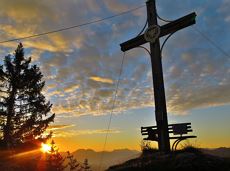
Astberg, Going

Hochsöll

Wandelen

Gemakkelijk

6:45 u

20,0 km

720 Hoogtemeters

Pölvenau circular route

Pölvenau circular route
Gedeeltelijk openPölvenau circular route
Pölvenau circular route

Pleasant circular hiking trail through forests and meadows to the romantically situated moor lake.
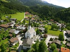
Hiking starting point Franzlhof, Söll (703 m)

Hiking starting point Franzlhof, Söll (703 m)

Wandelen

Normaal

2:00 u

5,7 km

240 Hoogtemeters

Schattseit trail route

Schattseit trail route

Quietness, strength and with easy breathing steadily closer to the Wilder Kaiser. You can return on foot or by bus.

Hiking starting point Bergbahn, Söll (724 m)

Gasthof Bocking, Söll (665 m)

Wandelen

Gemakkelijk

1:45 u

5,5 km

100 Hoogtemeters