


 Deutsch


Parking lot Tannbichl, Going (subject to charge)

Open - Today
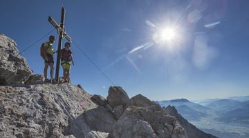
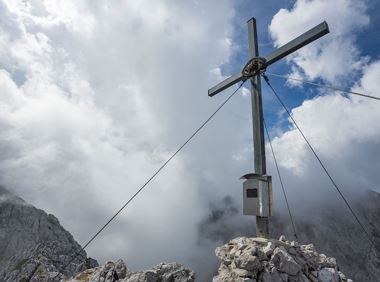
Going am Wilden Kaiser
Read more
The composition of the trail varies between forest road, trail, meadow path, gravel, forest trail, rocky passages with some sections secured by ropes and short climbing sections.
Rucksack, sturdy hiking/mountaineering boots with anti-slip treaded soles, weather-appropriate hiking gear (breathable), a change of clothes, sun protection (sunglasses, sun cream, lip protection, headgear), waterproofs (rain jacket/poncho, pocket umbrella, rucksack protector), cold protection (hat, gloves), sufficient food and drink, hiking poles (height adjustable) if required, first aid kit incl. rescue blanket and bivouac sack, mobile phone with fully charged battery, headlamp, plastic bag for waste, hiking map, route description and information materials (GPX track), ID, insurance card, cash and helmet
Read more
KaiserJet stop “Going Pramakapelle” – followed by approx. 25-minute hike to the hiking starting point (Tannbichl).
More information at: www.wilderkaiser.info
Heading from St. Johann on the B178 road, take the Going Prama exit immediately after passing the Stanglwirt hotel. Drive straight on along the road in the direction of the Kaisergebirge mountain range. After passing the last of the houses, keep to the right as you head towards the Kaisergebirge until you reach the hiking starting point and the car park.
Heading from Wörgl or Kufstein on the B178 road, take the Going Prama exit before you reach the Stanglwirt hotel. Drive straight on along the road in the direction of the Kaisergebirge mountain range. After passing the last of the houses, keep to the right as you head towards the Kaisergebirge until you reach the hiking starting point and the car park.
Tannbichl car park, Going (857 m) - pay & display
It is a day car park, which means that no ticket can be purchased for several days. The parking ticket is therefore only valid on the day of issue!
Read more
Fitness
Technical
Experience
01
Jan
02
Feb
03
Mrz
04
Apr
05
May
06
Jun
07
Jul
08
Aug
09
Sep
10
Oct
11
Nov
12
Dec
Open - Today
Going am Wilden Kaiser
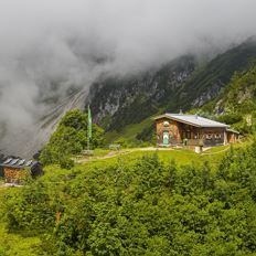
Going am Wilden Kaiser
(0043) 6646114626
Varied and challenging loop over the Scheffauer summit.
Kaindlhütte, Scheffau (1,293 m)
Scheffauer (2,111 m)
Hiking
Difficult
8:30 h
13,0 km
1400 Elevation gain
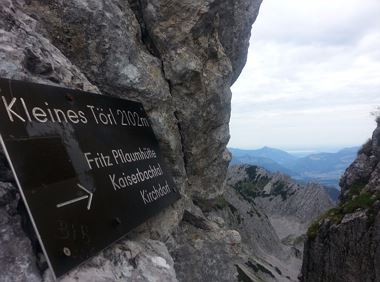
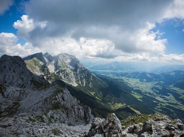
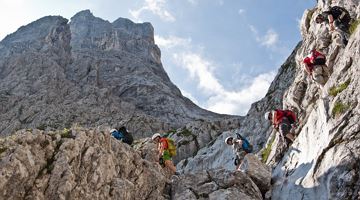
Demanding mountain tour to the Kleines Törl pass, the little brother of the Ellmauer Tor in the Ostkaiser.
Hiking starting point Tannbichl, Going (855 m)
Hiking starting point Tannbichl, Going (855 m)
Hiking
Difficult
8:00 h
12,0 km
1260 Elevation gain
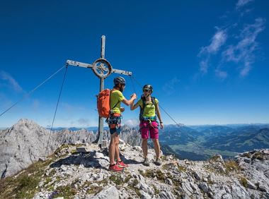
Two very demanding, fantastic lookout peaks on the Wilder Kaiser, which are not to be underestimated.
Hiking starting point Wegscheid, Scheffau (883 m)
Hiking starting point Wegscheid, Scheffau (883 m)
Hiking
Difficult
9:00 h
11,0 km
1440 Elevation gain
A demanding mountain tour with some ferrata passages up to the highest summit in the Wilder Kaiser (2,344 m).
Hiking starting point Wochenbrunner Alm, Ellmau (1,085 m)
Hiking starting point Wochenbrunner Alm, Ellmau (1,085 m)
Hiking
Difficult
7:30 h
9,3 km
1250 Elevation gain
The Hintere Goinger Halt (2,193 m) is considered to be the easiest summit to reach in the Wilder Kaiser.
Hiking starting point Wochenbrunner Alm, Ellmau (1,085 m)
Hiking starting point Wochenbrunner Alm, Ellmau (1,085 m)
Hiking
Difficult
6:30 h
8,9 km
1090 Elevation gain
Approaching from the north, this trail leads through the Steinerne Rinne to the majestic Ellmauer Tor.
Griesner Alm, 988 m
Wochenbrunner Alm, Ellmau (1,085 m)
Hiking
Difficult
5:45 h
8,1 km
1060 Elevation gain
2025-04-19
5 °C
2025-04-19
17 °C
2025-04-20
19 °C
2025-04-21
16 °C
