Hoppala, route niet gevonden

De door u opgevraagde pagina is niet beschikbaar. U bent welkom om een nieuwe zoekopdracht op deze pagina te starten.

0 Routes & tochten

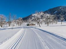
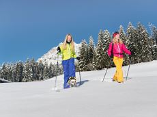
Winter walk on Hartkaiser

Winter walk on Hartkaiser

A short winter walk on Hartkaiser hrough Ellmi's magical world.

Hiking starting point Tourist Info, Ellmau (800 m)

Hiking starting point Tourist Info, Ellmau (800 m)

Wandelen

Gemakkelijk

0:30 u

1,0 km

25 Hoogtemeters

Prama circuit

Prama circuit
Prama circuit
Prama circuit

The Pramarunde circuit - a scenically beautiful circuit at all times of the year

Tourist Information Office, Going (766 m)

Tourist Information Office, Going (766 m)

Hardlopen

Gemakkelijk

0:30 u

4,4 km

70 Hoogtemeters

Circuit around Going

Circuit around Going

The circuit around Going is a lengthy and demanding tour with a great variety of different sections.

Tourist Information Office, Going (766 m)

Tourist Information Office, Going (766 m)

Hardlopen

Normaal

1:25 u

11,2 km

280 Hoogtemeters

Quellen circular route

Quellen circular route

Enjoy the scenic area of the Hohe Salve where the Söll waters originate.

Exit Keat chairlift, Söll (1,533 m)

Exit Keat chairlift, Söll (1,533 m)

Wandelen

Normaal

3:45 u

10,3 km

530 Hoogtemeters

Crystal clear streams

Crystal clear streams

Atmospheric forest walk along the snow-white creek.

Hiking starting point Tourist Info, Scheffau (738 m)

Hiking starting point Tourist Info, Scheffau (738 m)

Wandelen

Normaal

2:00 u

4,2 km

160 Hoogtemeters

Eagle Walk Stage 01: St. Johann in Tirol - Gaudeamushütte

Eagle Walk Stage 01: St. Johann in Tirol - Gaudeamushütte

Sturdy boots will help keep your ankles and feet happy on this hike, full of the best things Tirol has to offer: well-maintained trails, wildflowers galore and waterfalls beckon the adventurous hiker ready for a strenuous climb with breathtaking views of lofty Wilder Kaiser Mountain Range as your reward. The nature reserve’s landscape will win you over with its diverse beauty. The pasture regions are covered with soft grassy meadows, and hikers are greeted by lofty Wilder Kaiser Mountain Range with rugged Maukspitze, Ackerlspitze, Regalpspitze and Törlspitze Peaks, all “Two-Thousanders” that average 2,000 metres altitude. Trailhead is Rummlerhof Inn, northwest of the village centre of St. Johann. After a successful first segment, why not take a rest at Gaudeamus Hut, raise your glass and sing: “Gaudeamus igitur – Let us be happy!” For many hikers this is far enough, contentment has already set in. Adventurous souls continue on the trail that works its way up across Klamml Gorge to Grutten Hut, which entails another 400 metres of climbing.

Rummlerhof, St.Johann in Tirol

Gaudeamushütte

Wandelen

Normaal

5:00 u

13,0 km

1060 Hoogtemeters

Blaiken circular walk

Blaiken circular walk

A gentle walk to ancient farmsteads with a refreshment stop in a welcoming inn.

Hiking starting point Tourist Info, Scheffau (738 m)

Hiking starting point Tourist Info, Scheffau (738 m)

Wandelen

Gemakkelijk

1:30 u

3,8 km

80 Hoogtemeters

Scheffau – Gruttenhütte

Scheffau – Gruttenhütte

Hike to the Gruttenhütte with great views to the Ellmauer Halt and the entire region.

Hiking starting point Tourist Info, Scheffau (738 m)

Gruttenhütte, Ellmau (1,620 m)

Wandelen

Normaal

6:30 u

16,4 km

990 Hoogtemeters

Salvenblick hiking round

Salvenblick hiking round

Comfortable round with a magnificent view of the Hohe Salve.

Mountain station gondola Hexenwasser, Söll (1,150 m)

Mountain station gondola Hexenwasser, Söll (1,150 m)

Wandelen

Gemakkelijk

0:35 u

1,8 km

50 Hoogtemeters

Kaiserkrone - stage 4

Kaiserkrone - stage 4

Stripsenjochhaus – Stripsenkopf – Feldberg – Scheibenbichlalmen – Griesenau – Gasteig

Stripsenjochhaus, St. Johann in Tirol (1,577 m)

Gasteig (750 m)

Wandelen

Normaal

6:30 u

16,1 km

640 Hoogtemeters

Via ferrata s'Schuastagangl Steinplatte

Via ferrata s'Schuastagangl Steinplatte
OpenVia ferrata s'Schuastagangl Steinplatte
Via ferrata s'Schuastagangl Steinplatte

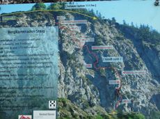
The classic on the Steinplatte Waidring was rehabilitated in June 2023 and is a treat for via ferrata fans! The via ferrata "s'Schuastagangl" (C/D) offers wonderful panoramic views, crisp ascents and unforgettable mountain moments. The varied tour leads through steep rock faces and slippery passages up to the summit of the Waidringer Steinplatte (1,848m). Strength for steeper ascents and courage for ladder passages and the "Knieschloderer" variant with airy steps and a rope bridge are required!

Via ferrata

Kaiserkrone - stage 5

Kaiserkrone - stage 5

Gasteig – Wilder-Kaiser-Steig – Ursulablick – Gscheuerkopf – Graspoint-Hochalm – Graspoint-Niederalm – Going, Hüttling

Gasteig (750 m)

Hiking starting point Hüttling, Going (820 m)

Wandelen

Normaal

5:15 u

10,8 km

840 Hoogtemeters

MTB-Tour around Juffinger Jöchl

MTB-Tour around Juffinger Jöchl

A crisp, varied tour from Söll via the Lengau to Bad Häring and over the Werlberg, past the Juffinger Jöchl back to Söll. Between the individual forest sections, you are rewarded again and again with magnificent views of large parts of the Inntal valley.

Village centre, Söll (689 m)

Village centre, Söll (689 m)

Fietsen

Moeilijk

24,0 km

900 Hoogtemeters

Söller village tour

Söller village tour
Söller village tour
Söller village tour

Looping the village of Söll, the sight seeing hike!

Hiking starting point Tourist Info, Söll (689 m)

Hiking starting point Tourist Info, Söll (689 m)

Wandelen

Gemakkelijk

1:00 u

3,7 km

50 Hoogtemeters

3-day mountain hut tour - overall itinerary

3-day mountain hut tour - overall itinerary

Going, Hüttling - Schleierwasserfall - Obere Regalm - Baumgartenköpfl (Bergsteigergrab) - Gaudeamushütte - Ellmauer Tor - Hintere Goinger Halt - Jubiläumssteig - Gruttenhütte - Kaiser-Hochalm - Steiner-Hochalm - Hinterschießling Alm - Rehbachklamm - Scheffau, Dorf

Hiking starting point Hüttling, Going (820 m)

Scheffau village (738 m)

Wandelen

Moeilijk

14:00 u

24,6 km

2060 Hoogtemeters

Ellmau circuit

Ellmau circuit
Ellmau circuit
Ellmau circuit

A beautiful easy hike at the foot of the Wilder Kaiser

Hiking starting point Tourist Info, Ellmau (800 m)

Hiking starting point Tourist Info, Ellmau (800 m)

Wandelen

Gemakkelijk

1:45 u

5,9 km

60 Hoogtemeters

SkiWelt Panoramic Trail

SkiWelt Panoramic Trail

The highlight for everyone who loves hiking for pleasure - lush Alpine meadows, sparkling mountain lakes and delightful food in the Kitzbühel Alps. And the Bergbahnen Wilder Kaiser - Brixental summer cable cars make the ascent and descent easy.

Astberg, Going

Hochsöll

Wandelen

Gemakkelijk

6:45 u

20,0 km

720 Hoogtemeters

Kaiserkrone - alternative route crossing through the Ellmauer Tor (Eggersteig trail - Jubiläumssteig trail)
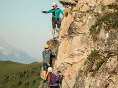
Kaiserkrone - alternative route crossing through the Ellmauer Tor (Eggersteig trail - Jubiläumssteig trail)

Stripsenjochhaus – Eggersteig – Steinerne Rinne – Ellmauer Tor – Jubiläumssteig – Gruttenhütte

Stripsenjochhaus, St. Johann in Tirol (1,577 m)

Gaudeamushütte, Going (1,263 m)

Wandelen

Moeilijk

5:00 u

6,3 km

590 Hoogtemeters

Hochlechen circular route

Hochlechen circular route

Old path - now renovated and featuring a pleasant series of ascents and descents.

Hiking starting point Bergbahn, Söll (725 m)

Hiking starting point Bergbahn, Söll (725 m)

Wandelen

Normaal

4:30 u

13,5 km

470 Hoogtemeters